MyTopo
Iron Mountain Texas US Topo Map
Couldn't load pickup availability
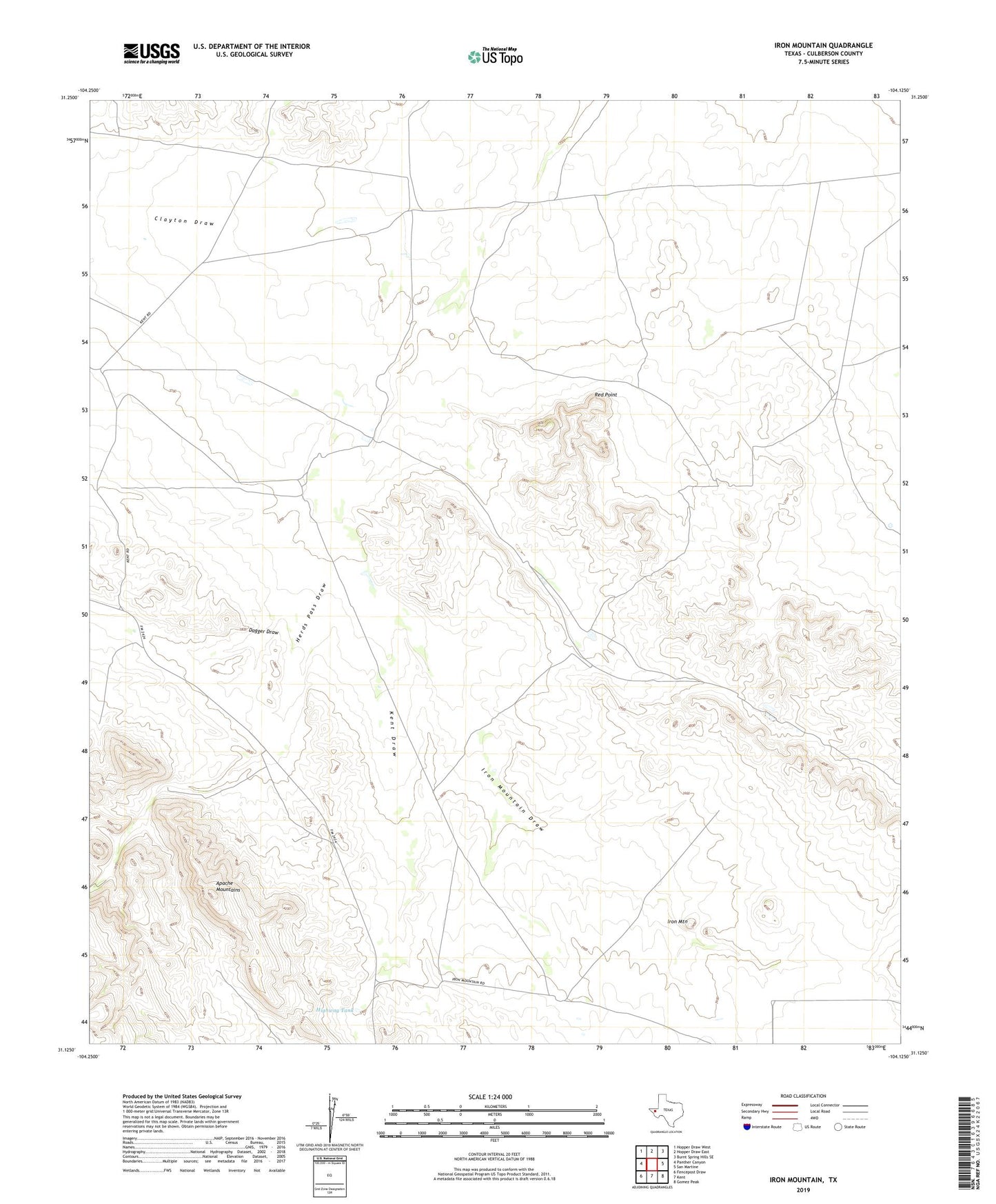
2022 topographic map quadrangle Iron Mountain in the state of Texas. Scale: 1:24000. Based on the newly updated USGS 7.5' US Topo map series, this map is in the following counties: Culberson. The map contains contour data, water features, and other items you are used to seeing on USGS maps, but also has updated roads and other features. This is the next generation of topographic maps. Printed on high-quality waterproof paper with UV fade-resistant inks.
Quads adjacent to this one:
West: Panther Canyon
Northwest: Hopper Draw West
North: Hopper Draw East
Northeast: Burnt Spring Hills SE
East: San Martine
Southeast: Gomez Peak
South: Kent
Southwest: Fencepost Draw
This map covers the same area as the classic USGS quad with code o31104b2.
Contains the following named places: Cam, Center Windmill, Clayton Draw, Dagger Draw, Foster Windmill, Goat Shed Waterhole, Highway Tank, Iron Mountain, Iron Mountain Draw, Kent Draw, Mountain Windmill, North Windmill, Pistola Windmill, Red Point, Sulphur Windmill, Wooden Windmill