MyTopo
Horse Camp Waterhole Texas US Topo Map
Couldn't load pickup availability
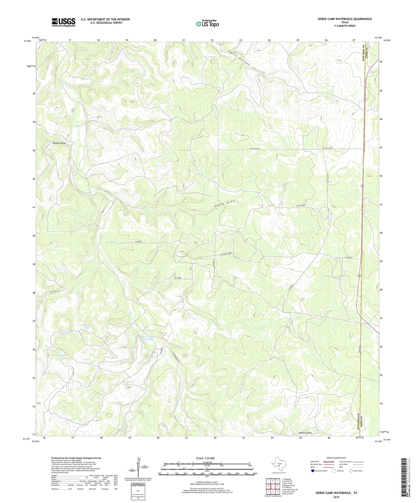
2022 topographic map quadrangle Horse Camp Waterhole in the state of Texas. Scale: 1:24000. Based on the newly updated USGS 7.5' US Topo map series, this map is in the following counties: Edwards, Kerr. The map contains contour data, water features, and other items you are used to seeing on USGS maps, but also has updated roads and other features. This is the next generation of topographic maps. Printed on high-quality waterproof paper with UV fade-resistant inks.
Quads adjacent to this one:
West: Bradford Creek
Northwest: Telegraph
North: Junction SE
Northeast: Allen Creek
East: Y O Ranch
Southeast: Garven Store
South: Earwood Creek
Southwest: Earwood Creek SW
This map covers the same area as the classic USGS quad with code o30099b7.
Contains the following named places: Beasley Draw, Bundy-Ross Ranch, Cedar Tank, Deer Leg Windmill, Earwood Creek, Goat Tank, Horse Camp Waterhole, Hunger Creek, Jackson Ranch, Louise Windmill, Lydle Draw, Paint Creek Windmill, Sampson Windmill, Valentine Tank, Wildcat Draw