MyTopo
Indian Lake Texas US Topo Map
Couldn't load pickup availability
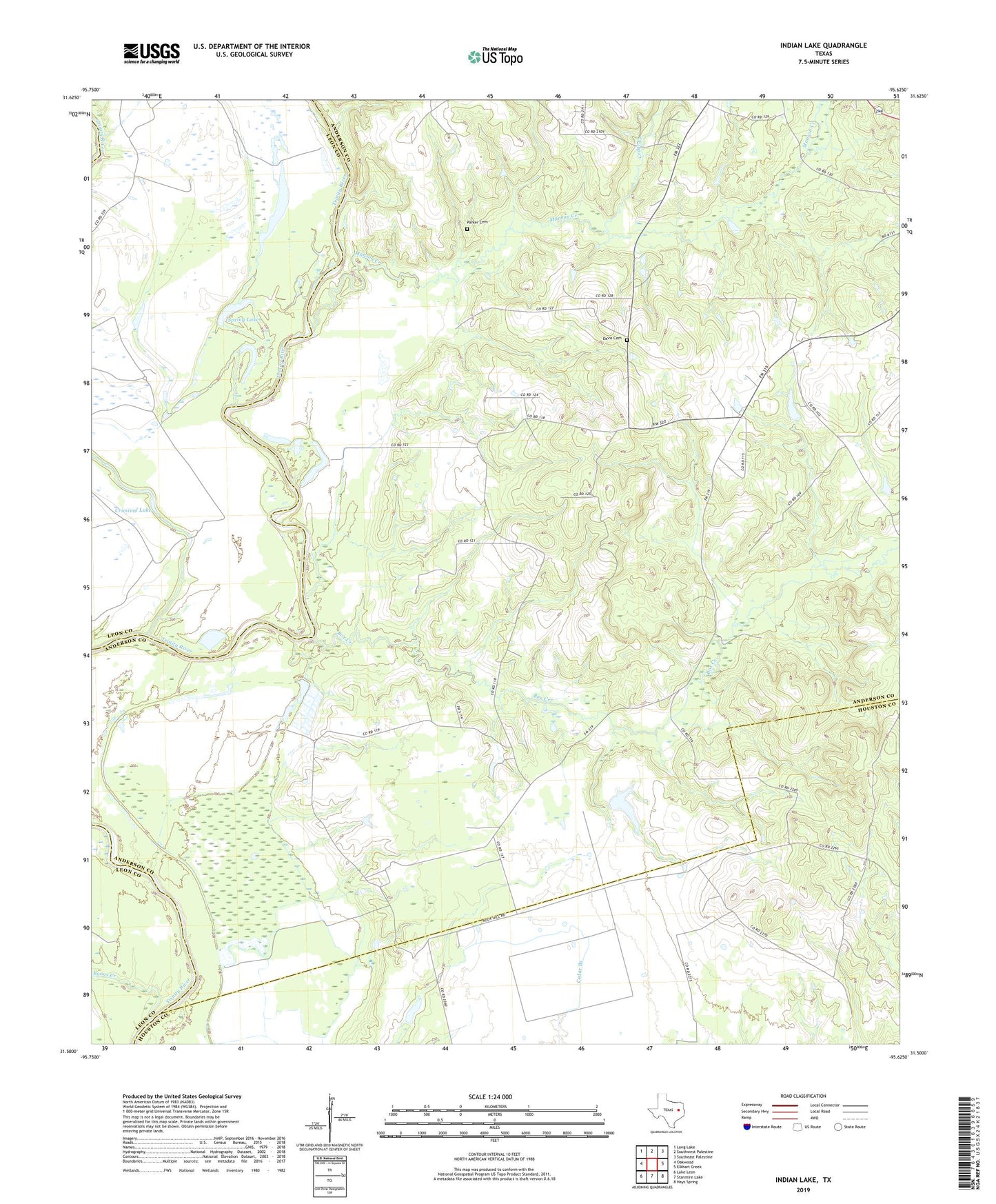
2019 topographic map quadrangle Indian Lake in the state of Texas. Scale: 1:24000. Based on the newly updated USGS 7.5' US Topo map series, this map is in the following counties: Anderson, Leon, Houston. The map contains contour data, water features, and other items you are used to seeing on USGS maps, but also has updated roads and other features. This is the next generation of topographic maps. Printed on high-quality waterproof paper with UV fade-resistant inks.
Quads adjacent to this one:
West: Oakwood
Northwest: Long Lake
North: Southwest Palestine
Northeast: Southeast Palestine
East: Elkhart Creek
Southeast: Hays Spring
South: Stanmire Lake
Southwest: Lake Leon
Contains the following named places: Boons Creek, Box Creek, Box Creek School, Cedar Creek, County Line School, Davis Cemetery, Galilee Church, Indian Lake, Magnolia School, Manson Creek, Myrtle Springs School, Parker Cemetery, River Bend Church, Rock Hill Church, Saint Anna Church, Spring Lake, Tabernacle Church