MyTopo
Iowa Park Texas US Topo Map
Couldn't load pickup availability
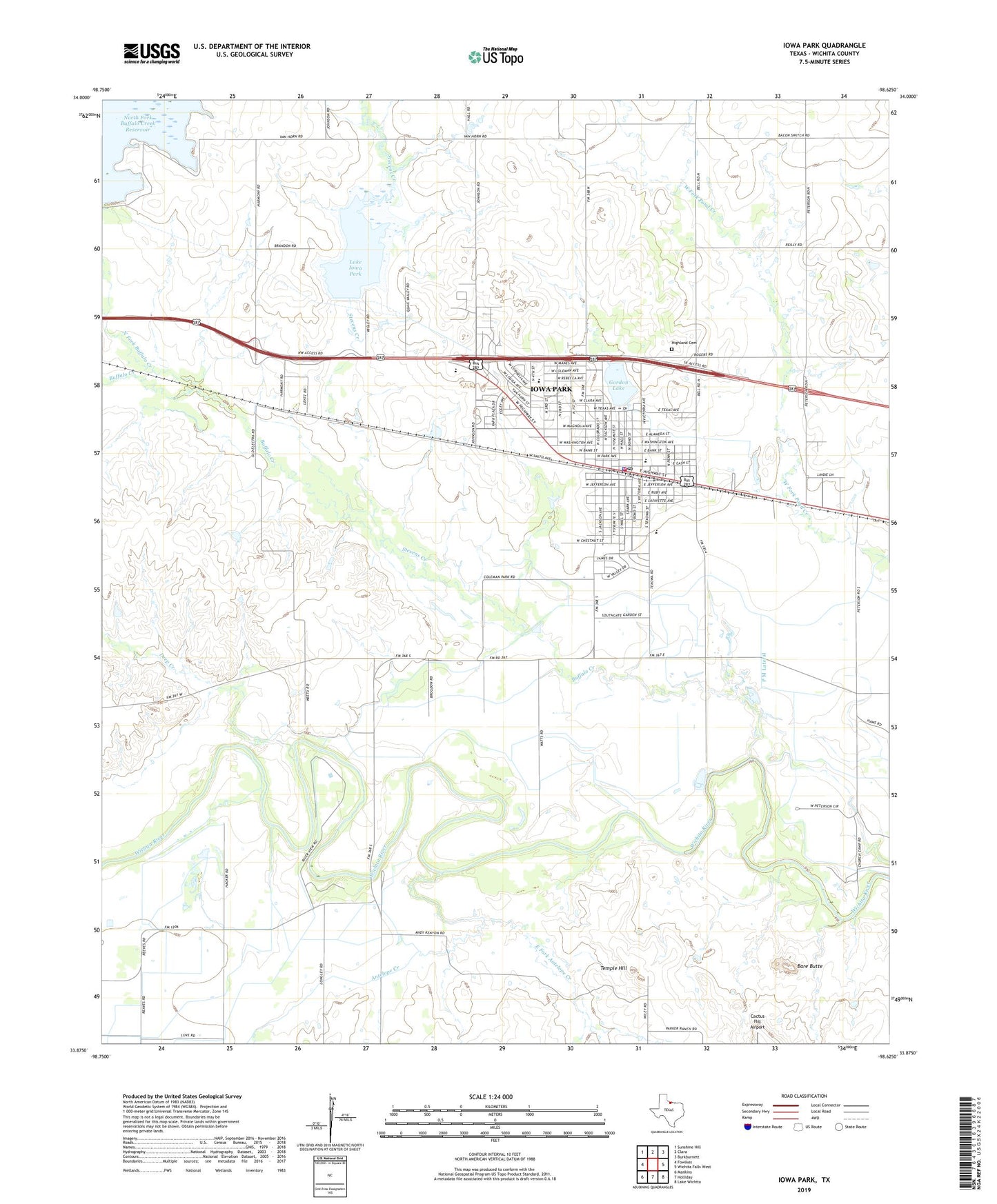
2019 topographic map quadrangle Iowa Park in the state of Texas. Scale: 1:24000. Based on the newly updated USGS 7.5' US Topo map series, this map is in the following counties: Wichita. The map contains contour data, water features, and other items you are used to seeing on USGS maps, but also has updated roads and other features. This is the next generation of topographic maps. Printed on high-quality waterproof paper with UV fade-resistant inks.
Quads adjacent to this one:
West: Fowlkes
Northwest: Sunshine Hill
North: Clara
Northeast: Burkburnett
East: Wichita Falls West
Southeast: Lake Wichita
South: Holliday
Southwest: Mankins
Contains the following named places: Antelope Creek, Antelope Park, Bare Butte, Boerne Public Library, Bradford Elementary School, Bradford School, Buffalo Creek, Burnett Park, Camp Chaparral Baptist Assembly Church, Christ the King Catholic Church, Church of Christ of Iowa Park, Church of God, City of Iowa Park, Cornerstone Pentecostal Church of God, Deep Creek, East Fork Antelope Creek, First Assembly of God Iowa Park Church, First Baptist Church of Iowa Park, First Presbyterian Church of Iowa Park, First United Methodist Church of Iowa Park, Gordon Lake, Highland Cemetery, Iowa Park, Iowa Park Church of God, Iowa Park City Hall, Iowa Park Division, Iowa Park Police Department, Iowa Park Post Office, Iowa Park Volunteer Fire Department, Kidwell Elementary School, Kidwell School, Lake Gordon Dam, Lake Iowa Park, Lake Iowa Park Dam, Lutheran Church Good Shepherd, N F Lateral, North Fork Buffalo Creek, P M Lateral, Pacific Avenue Missionary Baptist Church, South Fork Buffalo Creek, Stevens Creek, Temple Hill, United Pentecostal Church, W F George Middle School, Wichita County, Wichita County Constable's Office Precinct 3, ZIP Code: 76367