MyTopo
Fowlkes Texas US Topo Map
Couldn't load pickup availability
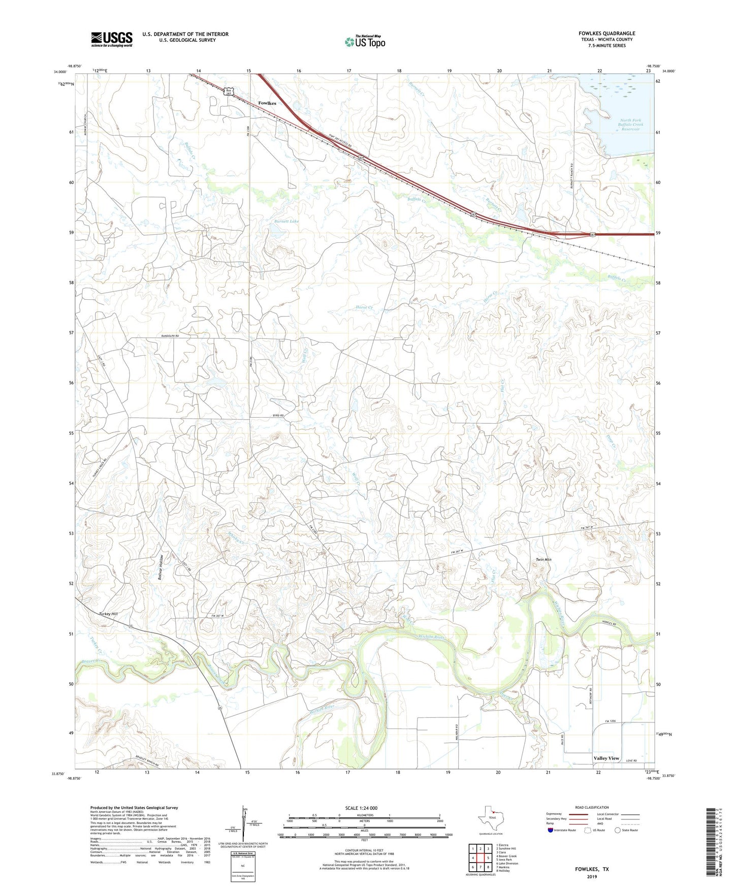
2022 topographic map quadrangle Fowlkes in the state of Texas. Scale: 1:24000. Based on the newly updated USGS 7.5' US Topo map series, this map is in the following counties: Wichita. The map contains contour data, water features, and other items you are used to seeing on USGS maps, but also has updated roads and other features. This is the next generation of topographic maps. Printed on high-quality waterproof paper with UV fade-resistant inks.
Quads adjacent to this one:
West: Beaver Creek
Northwest: Electra
North: Sunshine Hill
Northeast: Clara
East: Iowa Park
Southeast: Holliday
South: Mankins
Southwest: Lake Diversion
This map covers the same area as the classic USGS quad with code o33098h7.
Contains the following named places: Beaver Creek, Beaver Creek Lake, Beaver Creek Lake Dam, Bolivar Hollow, Burnett Creek, Burnett Lake, Burnett Lake Dam, Deer Creek, Electra Division, Flat Creek, Fowlkes, Horse Creek, North Fork Buffalo Creek Dam, Turkey Creek, Turkey Hill, Twin Mountain, Whisky Creek, Wolf Creek