
MyTopo
Iraan Texas US Topo Map
Couldn't load pickup availability
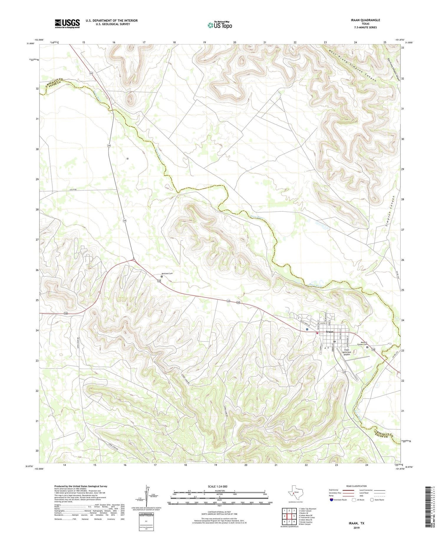
2019 topographic map quadrangle Iraan in the state of Texas. Scale: 1:24000. Based on the newly updated USGS 7.5' US Topo map series, this map is in the following counties: Pecos, Crockett. The map contains contour data, water features, and other items you are used to seeing on USGS maps, but also has updated roads and other features. This is the next generation of topographic maps. Printed on high-quality waterproof paper with UV fade-resistant inks.
Quads adjacent to this one:
West: Indian Mesa NE
Northwest: Table Top Mountain
North: Cedar Canyon
Northeast: Rankin SE
East: Twelvemile Camp
Southeast: Deer Canyon
South: Divide Country
Southwest: Indian Mesa SE
Contains the following named places: Brave Stadium, Camp Webb, City of Iraan, East Prong Simpson Canyon, Iraan, Iraan City Hall, Iraan City Park, Iraan Elementary School, Iraan General Hospital, Iraan High School, Iraan Junior High School, Iraan Municipal Airport, Iraan Post Office, Iraan Volunteer Fire Department and Emergency Medical Services, Memory Garden Cemetery, Pecos County Constable's Office Precinct 3, Restland Cemetery, Simpson Canyon, T Y C Sheffield Campus, West Prong Simpson Canyon, Yates Oil Field, ZIP Code: 79744


