MyTopo
Izoro Texas US Topo Map
Couldn't load pickup availability
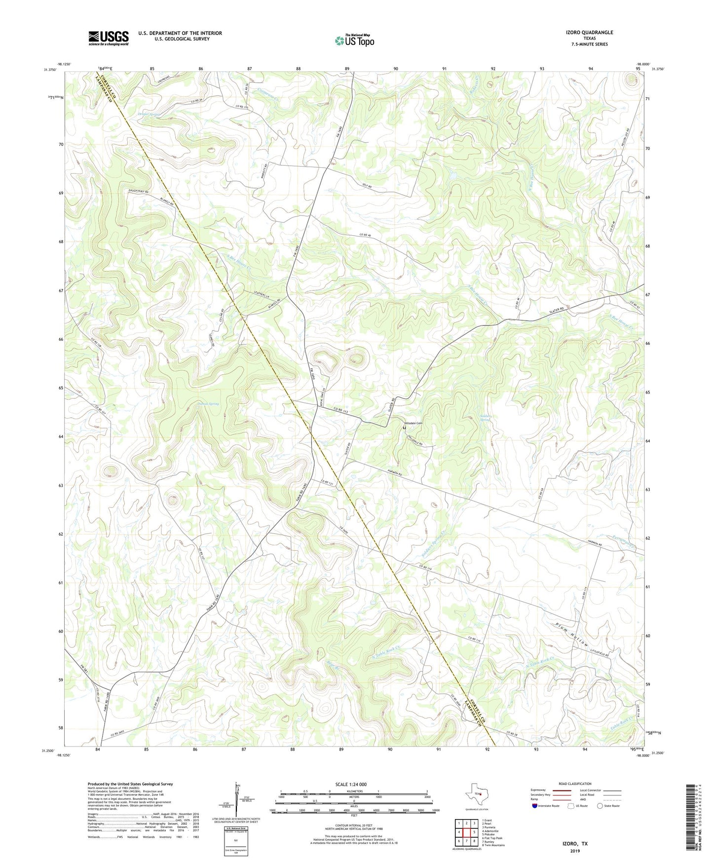
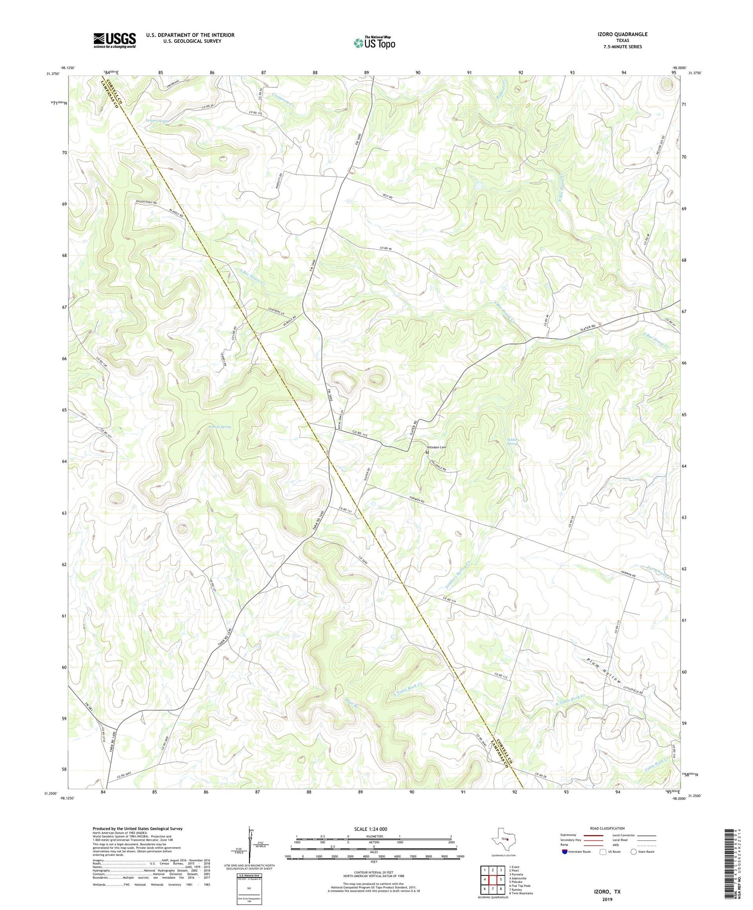
2019 topographic map quadrangle Izoro in the state of Texas. Scale: 1:24000. Based on the newly updated USGS 7.5' US Topo map series, this map is in the following counties: Coryell, Lampasas. The map contains contour data, water features, and other items you are used to seeing on USGS maps, but also has updated roads and other features. This is the next generation of topographic maps. Printed on high-quality waterproof paper with UV fade-resistant inks.
Quads adjacent to this one:
West: Adamsville
Northwest: Evant
North: Pearl
Northeast: Purmela
East: Pidcoke
Southeast: Twin Mountains
South: Rumley
Southwest: Flat Top Peak
Contains the following named places: Draper Spring, Dumas Spring, Evant Division, Hillsdale Cemetery, Hillsdale School, Izoro, Peabody School, Plum Hollow, Roberts Creek, Soldiers Spring, Soldiers Spring Creek