MyTopo
Rumley Texas US Topo Map
Couldn't load pickup availability
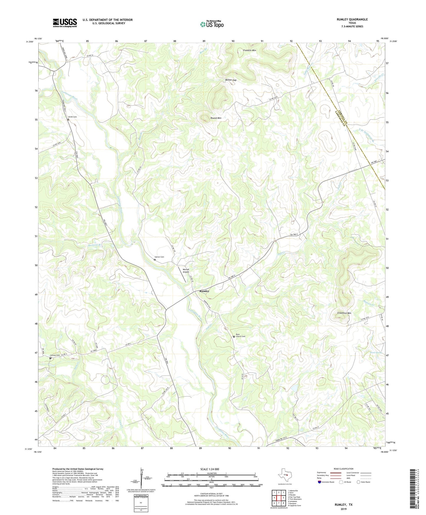
2022 topographic map quadrangle Rumley in the state of Texas. Scale: 1:24000. Based on the newly updated USGS 7.5' US Topo map series, this map is in the following counties: Lampasas, Coryell. The map contains contour data, water features, and other items you are used to seeing on USGS maps, but also has updated roads and other features. This is the next generation of topographic maps. Printed on high-quality waterproof paper with UV fade-resistant inks.
Quads adjacent to this one:
West: Flat Top Peak
Northwest: Adamsville
North: Izoro
Northeast: Pidcoke
East: Twin Mountains
Southeast: Copperas Cove
South: Kempner
Southwest: Lampasas
This map covers the same area as the classic USGS quad with code o31098b1.
Contains the following named places: Bear Branch, Belton Gap, Burleson Branch, Clay Rock Church, Crawford Mountain, Fall Creek, Franklin Mountain, Garner Cemetery, Groves Cemetery, Grundyville Church, Midway Church, Picnic Spring, Rock Church Cemetery, Round Mountain, Rumley, School Creek, School Creek Church, Smith Cemetery, Worrell Airport