MyTopo
Adamsville Texas US Topo Map
Couldn't load pickup availability
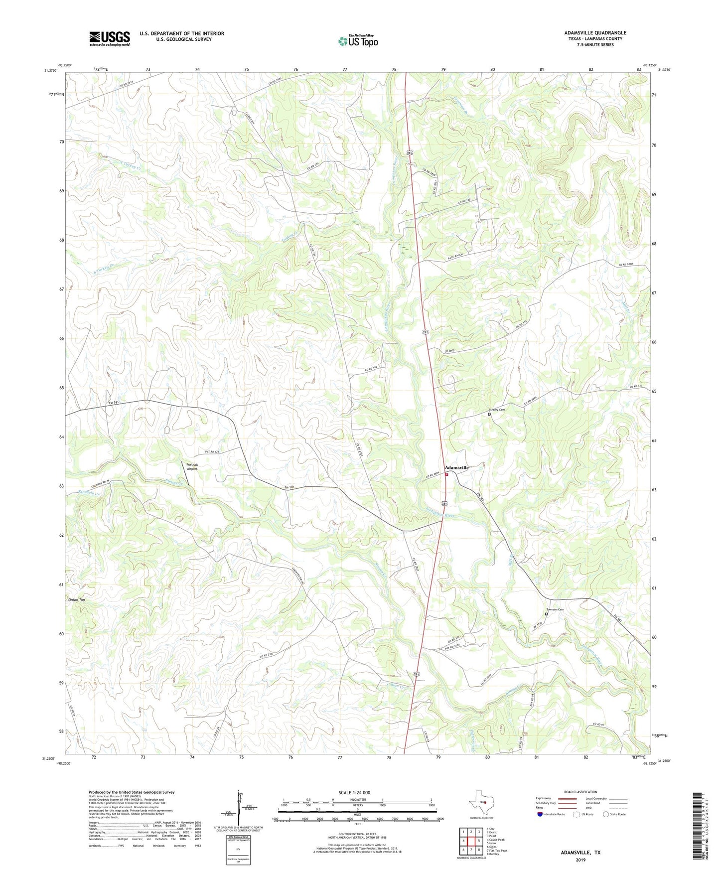
2022 topographic map quadrangle Adamsville in the state of Texas. Scale: 1:24000. Based on the newly updated USGS 7.5' US Topo map series, this map is in the following counties: Lampasas. The map contains contour data, water features, and other items you are used to seeing on USGS maps, but also has updated roads and other features. This is the next generation of topographic maps. Printed on high-quality waterproof paper with UV fade-resistant inks.
Quads adjacent to this one:
West: Castle Peak
Northwest: Star
North: Evant
Northeast: Pearl
East: Izoro
Southeast: Rumley
South: Flat Top Peak
Southwest: Ogles
This map covers the same area as the classic USGS quad with code o31098c2.
Contains the following named places: Adamsville, Adamsville Division, Adamsville Fire Department, Capital Ambulance Service, Freeman Branch, Friendship School, Indian Creek, Kinchelo Creek, Mill Branch, North Turkey Creek, Patterson Creek, Postoak Airport, Simms Creek, South Turkey Creek, Straley Cemetery, Townsen Cemetery, Turkey Creek