MyTopo
Jewett Texas US Topo Map
Couldn't load pickup availability
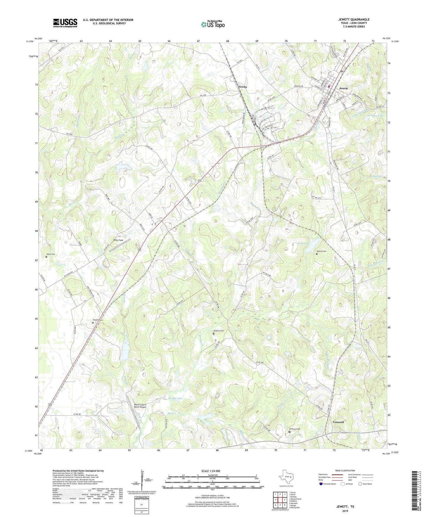
2019 topographic map quadrangle Jewett in the state of Texas. Scale: 1:24000. Based on the newly updated USGS 7.5' US Topo map series, this map is in the following counties: Leon. The map contains contour data, water features, and other items you are used to seeing on USGS maps, but also has updated roads and other features. This is the next generation of topographic maps. Printed on high-quality waterproof paper with UV fade-resistant inks.
Quads adjacent to this one:
West: Round Prairie
Northwest: Farrar
North: Donie
Northeast: Buffalo
East: Robbins
Southeast: Spring Seat
South: Margie
Southwest: Marquez
Contains the following named places: Big Branch, Birch Creek, Brushy Lake, Buck Creek, Burleson Cemetery, Carver School, Cedar Creek, City of Jewett, Concord, Concord Post Office, Ephesus Church, Independent School, Jewett, Jewett City Hall, Jewett Police Department, Jewett Post Office, Jewett Volunteer Fire Department, Jewett-Marquez Division, K and L Transport, Little Brushy Creek, McMillin Cemetery, Miles Field, Moore Cemetery, Morris Lazy K Ranch Airport, Mustang Creek, Newby, Peoples Cemetery, Rose Lake, Rose Lake Dam, Sand Branch, Sardis Church, Shaw Branch, Starrett Branch, Swindler Pond, Taylor Cemetery, Yellow Branch, ZIP Code: 75846