MyTopo
Marquez Texas US Topo Map
Couldn't load pickup availability
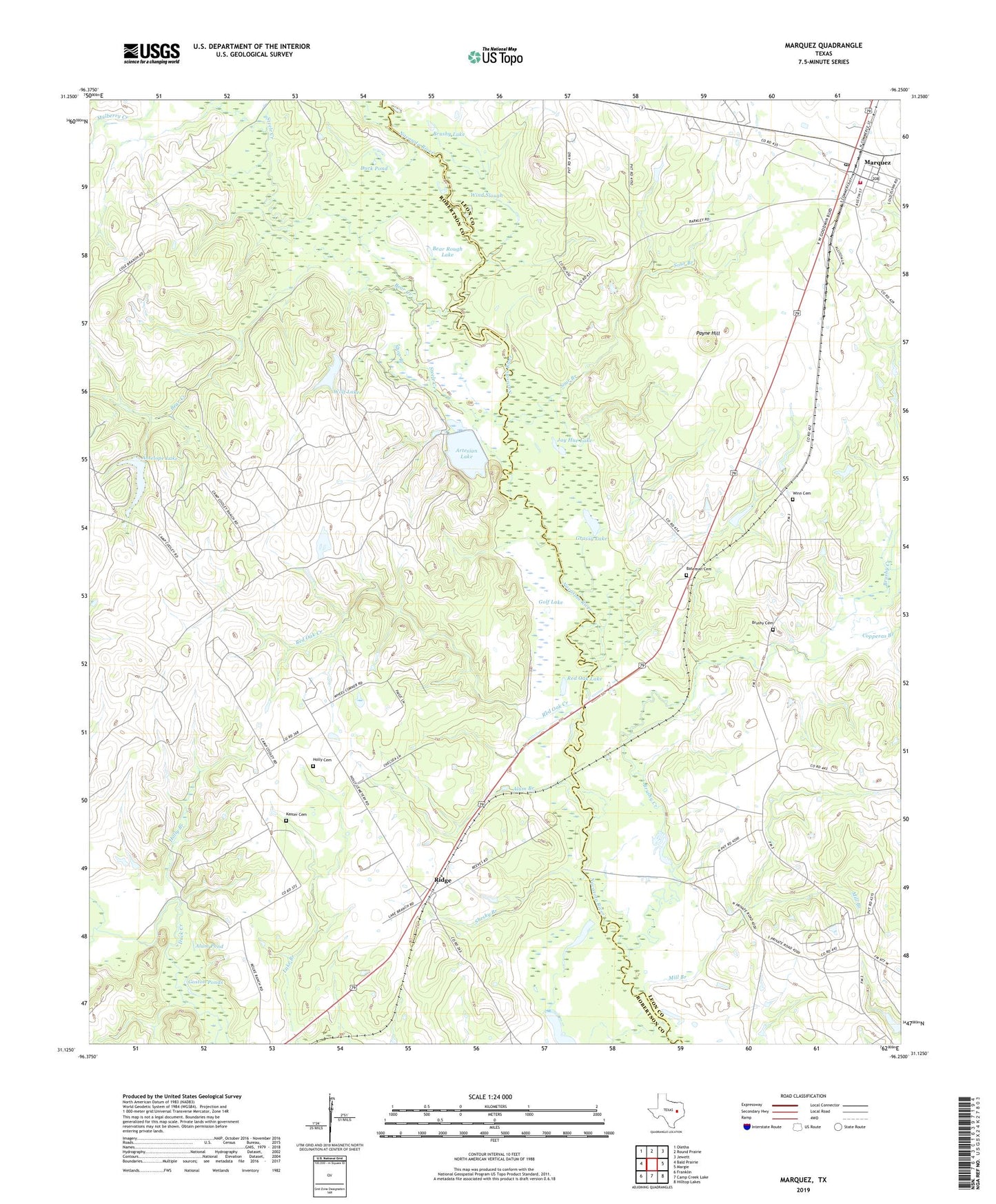
2022 topographic map quadrangle Marquez in the state of Texas. Scale: 1:24000. Based on the newly updated USGS 7.5' US Topo map series, this map is in the following counties: Robertson, Leon. The map contains contour data, water features, and other items you are used to seeing on USGS maps, but also has updated roads and other features. This is the next generation of topographic maps. Printed on high-quality waterproof paper with UV fade-resistant inks.
Quads adjacent to this one:
West: Bald Prairie
Northwest: Oletha
North: Round Prairie
Northeast: Jewett
East: Margie
Southeast: Hilltop Lakes
South: Camp Creek Lake
Southwest: Franklin
This map covers the same area as the classic USGS quad with code o31096b3.
Contains the following named places: Alum Branch, Alum Pond, Antelope Lake, Antelope Lake Dam, Artesian Lake, Artesian Lake Dam, Bateman Cemetery, Bear Creek, Bear Rough Lake, Brushy Cemetery, Brushy Creek, Brushy Lake, City of Marquez, Coles Branch, Copperas Branch, Duck Pond, Golf Lake, Goston Ponds, Grassy Lake, Holly Branch, Holly Cemetery, Holly Church, Jay Hue Lake, Kaster Cemetery, Kirk Holes, Lake Branch, Marquez, Marquez City Offices, Marquez Post Office, Marquez Volunteer Fire Department, Mill Branch, Mineral Creek, Payne Hill, Red Oak Creek, Red Oak Lake, Ridge, Shesky Branch, Shop Branch, Sour Branch, Steele Creek, Venetia, Watson Chapel, Wind Slough, Winn Cemetery, Wolf Lake, Wolf Lake Dam