MyTopo
Josephine Texas US Topo Map
Couldn't load pickup availability
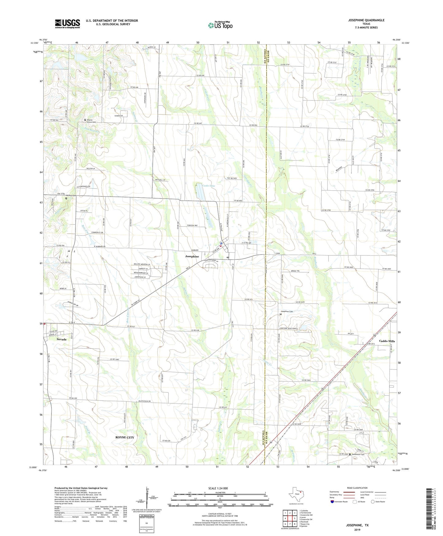
2019 topographic map quadrangle Josephine in the state of Texas. Scale: 1:24000. Based on the newly updated USGS 7.5' US Topo map series, this map is in the following counties: Collin, Hunt. The map contains contour data, water features, and other items you are used to seeing on USGS maps, but also has updated roads and other features. This is the next generation of topographic maps. Printed on high-quality waterproof paper with UV fade-resistant inks.
Quads adjacent to this one:
West: Lavon
Northwest: Culleoka
North: Farmersville
Northeast: Greenville NW
East: Greenville SW
Southeast: Quinlan
South: Royse City
Southwest: Rockwall
Contains the following named places: Burrow, City of Josephine, City of Nevada, Community High School, Community Middle School, Cooks Lake, Cowskin Creek, Josephine, Josephine Cemetery, Josephine City Hall, Josephine Police Department, Josephine Post Office, Josephine Volunteer Fire Department, McClendon Elementary School, McMinn Cemetery, Needmore Cemetery, Nevada, Nevada City Hall, Nevada Post Office, Payne Creek, Pleasant Valley, Prairie Grove Cemetery, Soil Conservation Service Site 85a Dam, Soil Conservation Service Site 85a Reservoir, Soil Conservation Service Site 85b Dam, Soil Conservation Service Site 85b Reservoir, ZIP Code: 75164