MyTopo
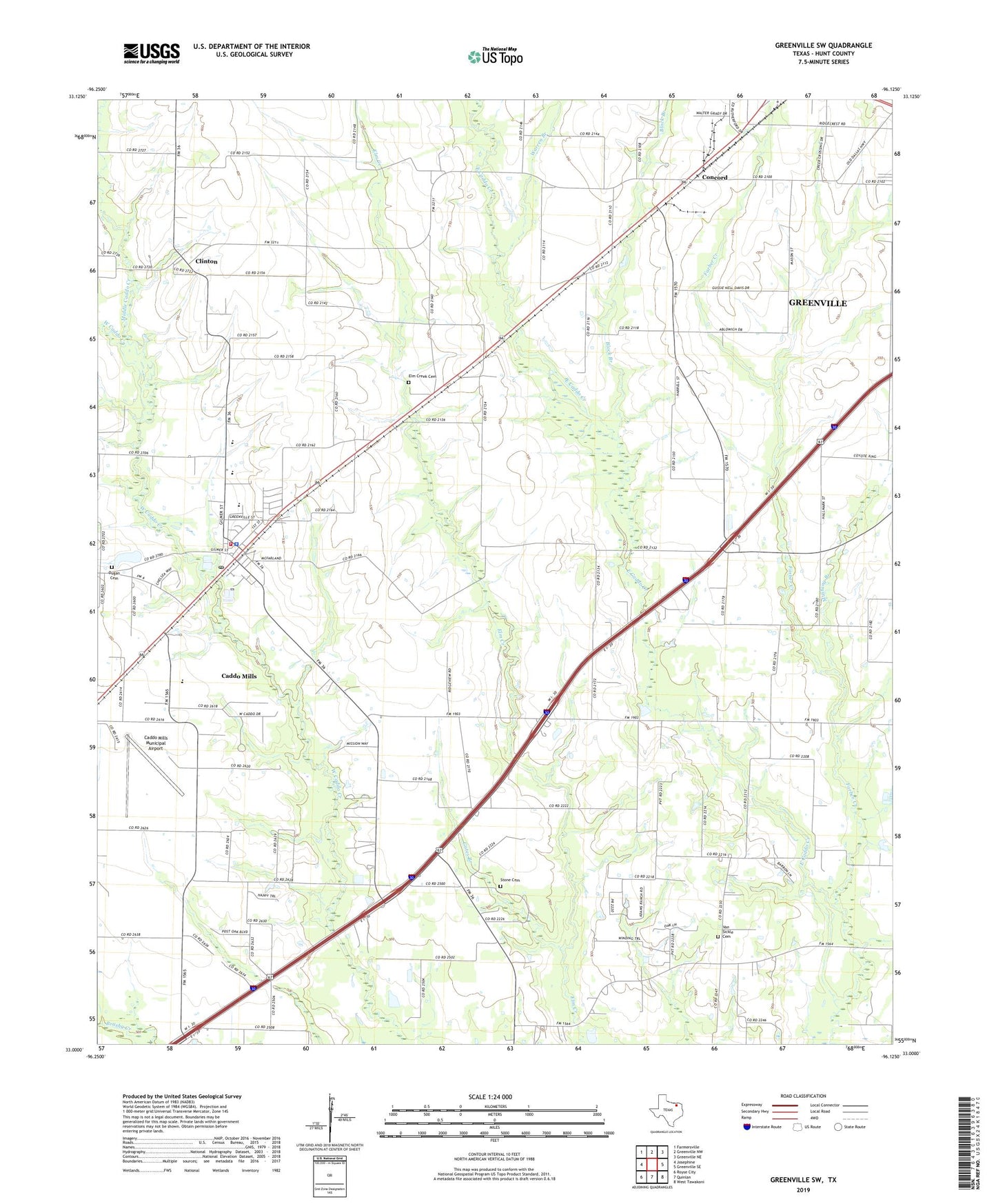
Greenville SW Texas US Topo Map
Couldn't load pickup availability
2022 topographic map quadrangle Greenville SW in the state of Texas. Scale: 1:24000. Based on the newly updated USGS 7.5' US Topo map series, this map is in the following counties: Hunt. The map contains contour data, water features, and other items you are used to seeing on USGS maps, but also has updated roads and other features. This is the next generation of topographic maps. Printed on high-quality waterproof paper with UV fade-resistant inks.
Quads adjacent to this one:
West: Josephine
Northwest: Farmersville
North: Greenville NW
Northeast: Greenville NE
East: Greenville SE
Southeast: West Tawakoni
South: Quinlan
Southwest: Royse City
This map covers the same area as the classic USGS quad with code o33096a2.
Contains the following named places: Block Branch, Caddo Mills, Caddo Mills City Hall, Caddo Mills Division, Caddo Mills Elementary School, Caddo Mills Fire / Rescue, Caddo Mills High School, Caddo Mills Middle School, Caddo Mills Municipal Airport, Caddo Mills Police Department, Caddo Mills Post Office, Cedar Grove Church, City of Caddo Mills Lake, City of Caddo Mills Lake Dam, Clinton, Concord, Dugan Cemetery, Elm Creek Cemetery, Farber Creek, Gates Branch, Hanchey Park, Hendrix, Meadowview Airport, Meadowview Community Center, Middle Caddo Creek, Mustang Branch, Odd Fellows Cemetery, Paradise Church, Stone Cemetery, Van Sickle Cemetery, Van Sickle Community Center, Warren Branch, ZIP Code: 75135