
MyTopo
Joshua Texas US Topo Map
Couldn't load pickup availability
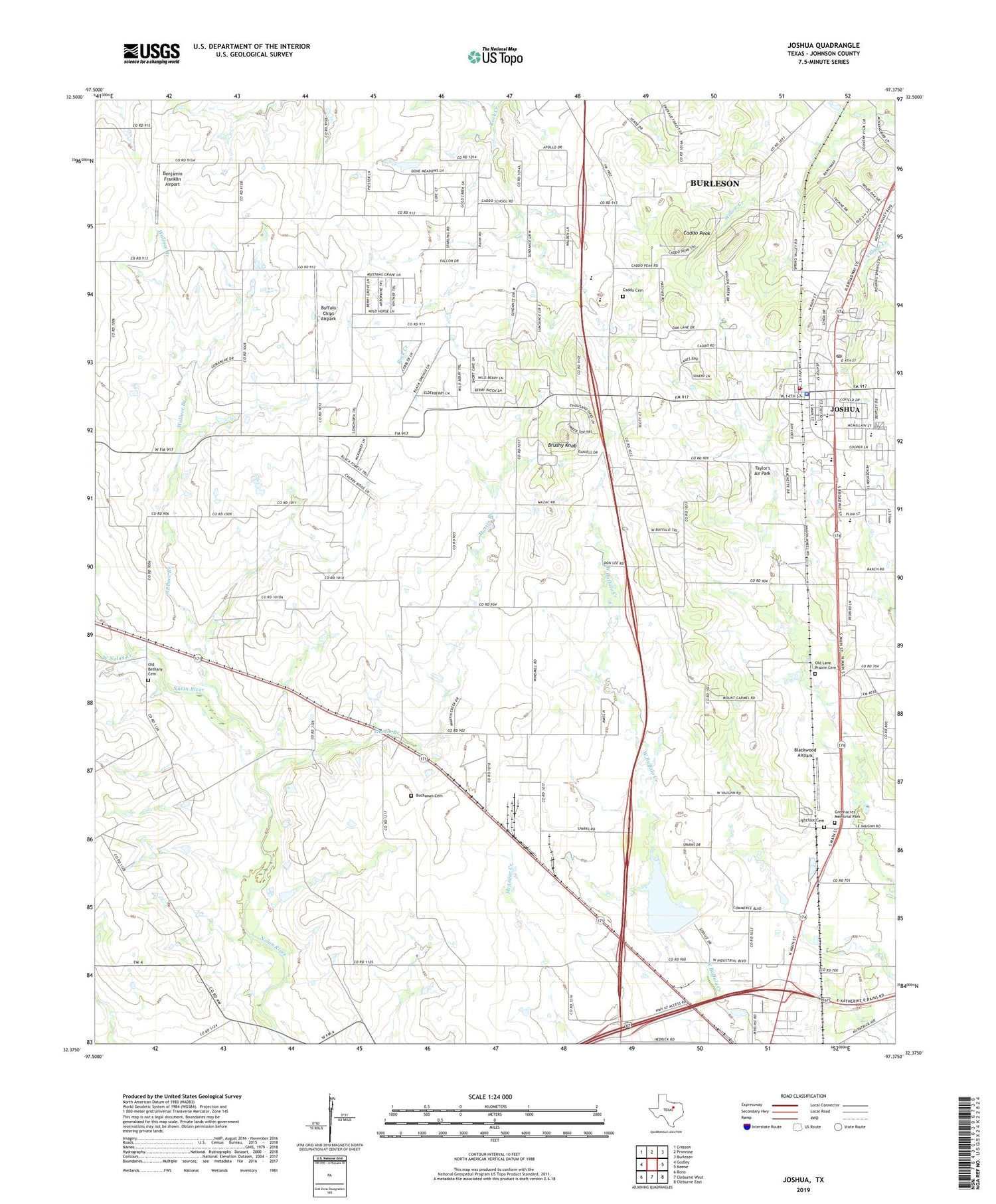
2019 topographic map quadrangle Joshua in the state of Texas. Scale: 1:24000. Based on the newly updated USGS 7.5' US Topo map series, this map is in the following counties: Johnson. The map contains contour data, water features, and other items you are used to seeing on USGS maps, but also has updated roads and other features. This is the next generation of topographic maps. Printed on high-quality waterproof paper with UV fade-resistant inks.
Quads adjacent to this one:
West: Godley
Northwest: Cresson
North: Primrose
Northeast: Burleson
East: Keene
Southeast: Cleburne East
South: Cleburne West
Southwest: Bono
Contains the following named places: A G Elder Elementary School, Accelerated Learning Center, Benjamin Franklin Airport, Blackwood Airpark, Brushy Knob, Buchanan, Buchanan Cemetery, Buffalo Chips Airpark, Burleson-Joshua Division, Caddo Cemetery, Caddo Peak, Calvary Chapel Church, City of Joshua, Green Acres Memorial Park, H D Staples Elementary School, Joshua, Joshua Baptist Church, Joshua City Hall, Joshua Fire Department, Joshua High School, Joshua Police Department, Joshua Post Office, Joshua Primary School, KCLE-AM (Cleburne), Lightfoot Cemetery, Martin Branch, Mount Carmel, Old Bethany Cemetery, Old Lane Prairie Cemetery, Owl Stadium, R C Loflin Middle School, Taylor's Air Park, Wallace Branch, West Nolan Creek, ZIP Code: 76058


