MyTopo
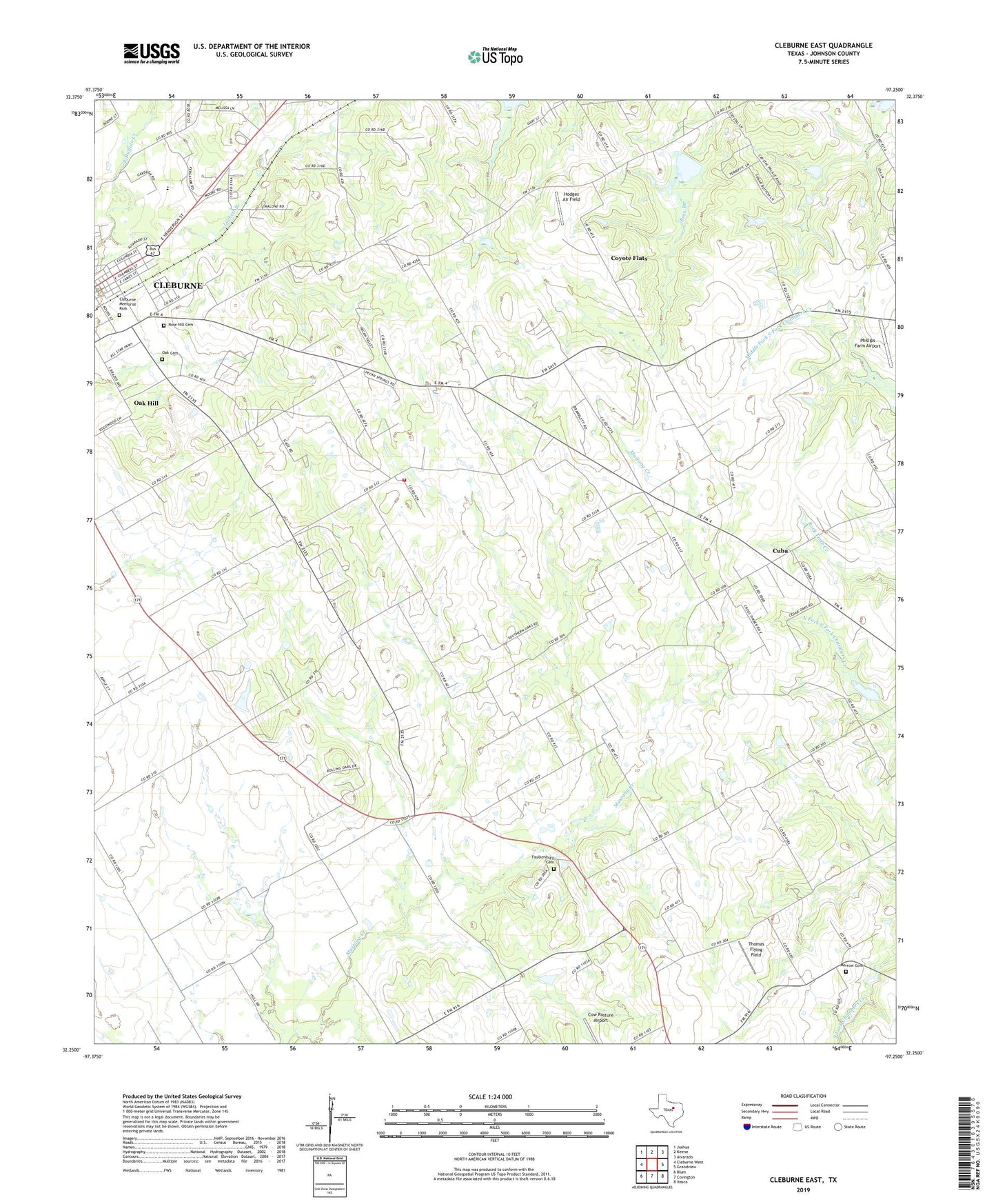
Cleburne East Texas US Topo Map
Couldn't load pickup availability
2022 topographic map quadrangle Cleburne East in the state of Texas. Scale: 1:24000. Based on the newly updated USGS 7.5' US Topo map series, this map is in the following counties: Johnson. The map contains contour data, water features, and other items you are used to seeing on USGS maps, but also has updated roads and other features. This is the next generation of topographic maps. Printed on high-quality waterproof paper with UV fade-resistant inks.
Quads adjacent to this one:
West: Cleburne West
Northwest: Joshua
North: Keene
Northeast: Alvarado
East: Grandview
Southeast: Itasca
South: Covington
Southwest: Blum
This map covers the same area as the classic USGS quad with code o32097c3.
Contains the following named places: Carver Park, City of Coyote Flats, Cleburne Memorial Cemetery, Coyote Flats Census Designated Place, Cuba, Faulkenbury Cemetery, Friendship Church, Friendship School, Greenlawn Cemetery, Hodges Air Field, Liberty Chapel School, Liberty Chapel Volunteer Fire Department, Lockett Branch, Morrow Cemetery, Oak Cemetery, Oak Hill, Phillips Farm Airport, Prices Chapel, Prices Chapel Cemetery, Rose Hill Cemetery, Sand Flat, Soil Conservation Service Site 38 Dam, Soil Conservation Service Site 38 Reservoir, Soil Conservation Service Site 61a Dam, Soil Conservation Service Site 61a Reservoir, Thomas Flying Field, Watts Chapel, ZIP Code: 76031