MyTopo
Cresson Texas US Topo Map
Couldn't load pickup availability
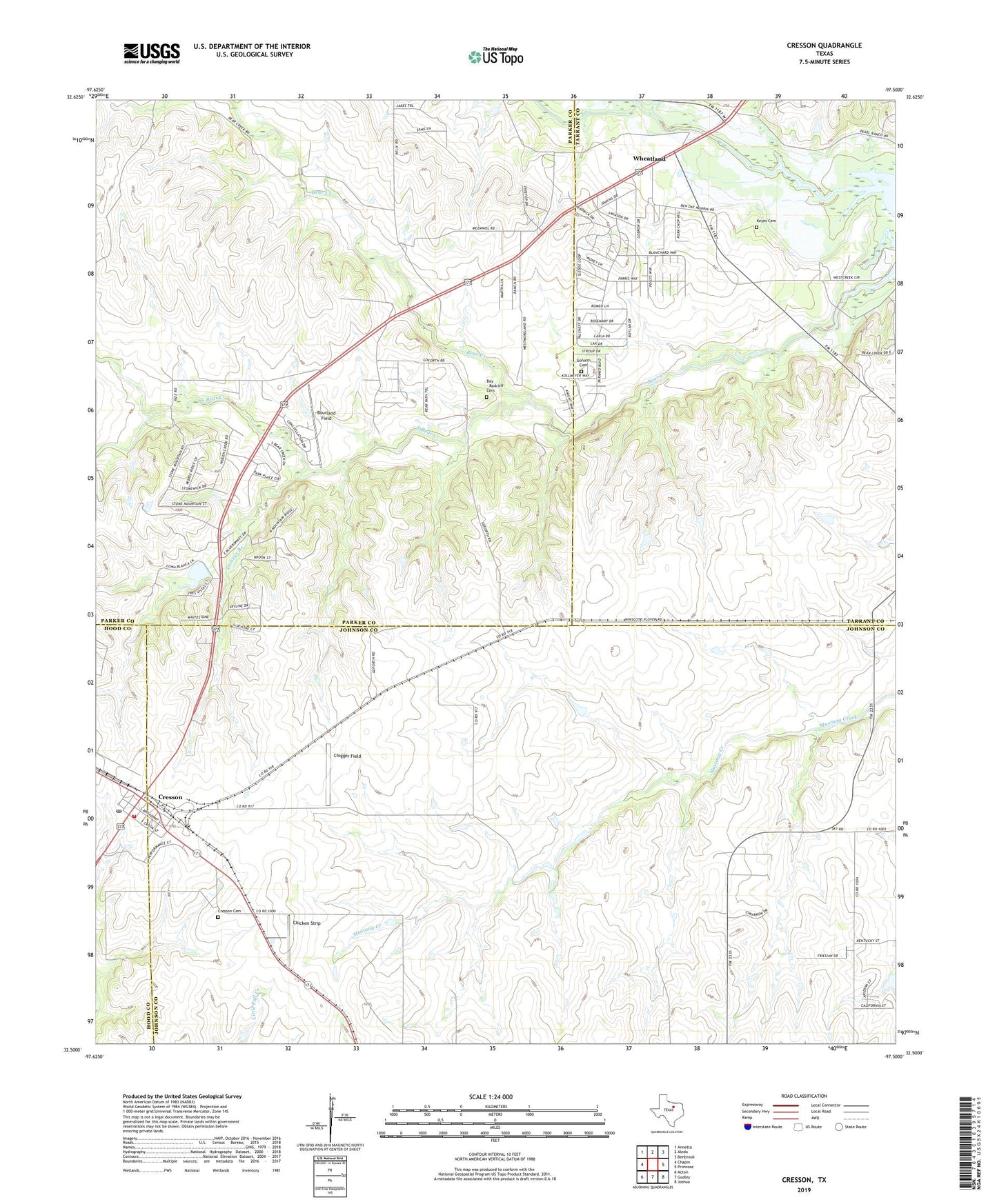
2022 topographic map quadrangle Cresson in the state of Texas. Scale: 1:24000. Based on the newly updated USGS 7.5' US Topo map series, this map is in the following counties: Johnson, Parker, Tarrant, Hood. The map contains contour data, water features, and other items you are used to seeing on USGS maps, but also has updated roads and other features. This is the next generation of topographic maps. Printed on high-quality waterproof paper with UV fade-resistant inks.
Quads adjacent to this one:
West: Chapin
Northwest: Annetta
North: Aledo
Northeast: Benbrook
East: Primrose
Southeast: Joshua
South: Godley
Southwest: Acton
This map covers the same area as the classic USGS quad with code o32097e5.
Contains the following named places: Bear Creek / Reynolds Cemetery, Boss, Bourland Field, Chicken Strip Airport, Chigger Field, City of Cresson, Clark Dam, Clark Lake, Cresson, Cresson Cemetery, Cresson City Office, Cresson Post Office, Cresson Volunteer Fire Department, Day - Radcliff Cemetery, Dickeys Branch, Goforth Cemetery, Keyes Cemetery, South Bear Creek, Wheatland, Wheatland School, Winscott