MyTopo
Jourdanton Texas US Topo Map
Couldn't load pickup availability
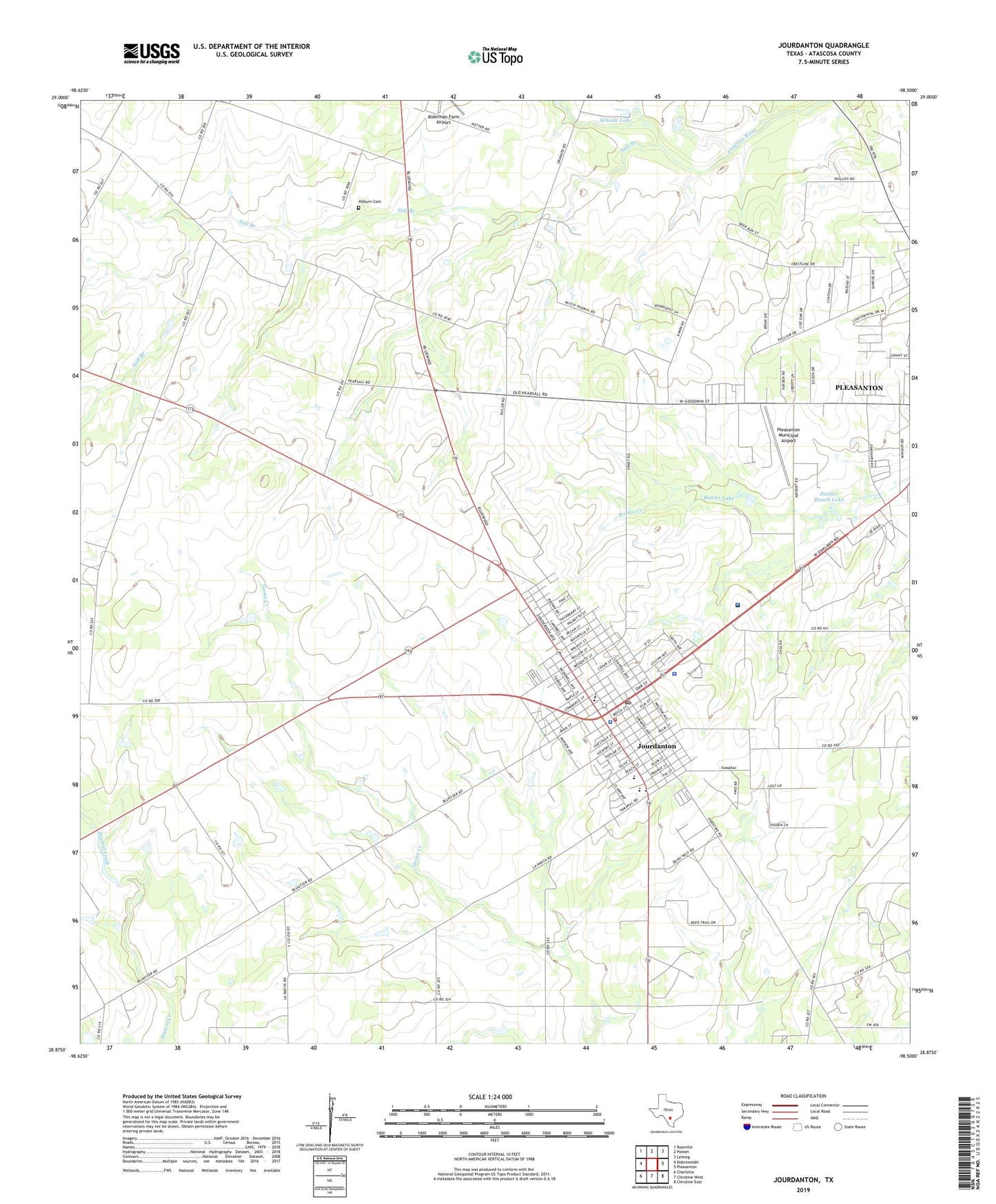
2019 topographic map quadrangle Jourdanton in the state of Texas. Scale: 1:24000. Based on the newly updated USGS 7.5' US Topo map series, this map is in the following counties: Atascosa. The map contains contour data, water features, and other items you are used to seeing on USGS maps, but also has updated roads and other features. This is the next generation of topographic maps. Printed on high-quality waterproof paper with UV fade-resistant inks.
Quads adjacent to this one:
West: Dobrowolski
Northwest: Rossville
North: Poteet
Northeast: Leming
East: Pleasanton
Southeast: Christine East
South: Christine West
Southwest: Charlotte
Contains the following named places: Atascosa County, Atascosa County Alternative School - Jourdanton, Atascosa County Alternative School - Pleasanton, Atascosa County Emergency Medical Services, Atascosa County Sheriff's Office, Bonita Dam, Bonita Lake, City of Jourdanton, Hilburn Cemetery, Jourdanton, Jourdanton City Hall, Jourdanton Elementary School, Jourdanton High School, Jourdanton Junior High School, Jourdanton Police Department, Jourdanton Post Office, Jourdanton Volunteer Fire Department, Mercy Hospital, Methodist Hospital South, Palmer Ranch Lake, Palmer Ranch Lake Dam, Pleasanton Municipal Airport, Salt Branch, Scheidt Dam, Scheidt Lake, The Church of Jesus Christ of Latter Day Saints, United Methodist Church, Westfall Branch Library