MyTopo
Leming Texas US Topo Map
Couldn't load pickup availability
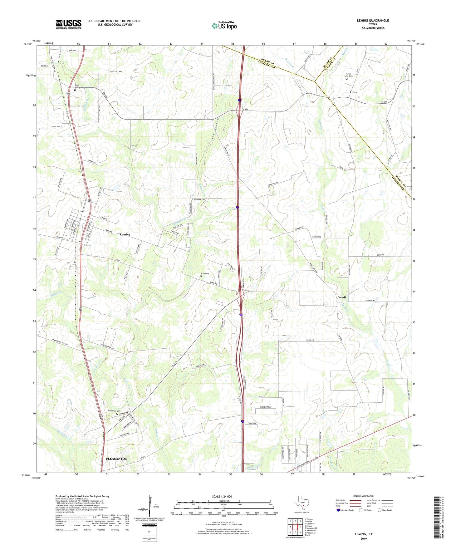
2022 topographic map quadrangle Leming in the state of Texas. Scale: 1:24000. Based on the newly updated USGS 7.5' US Topo map series, this map is in the following counties: Atascosa, Wilson, Bexar. The map contains contour data, water features, and other items you are used to seeing on USGS maps, but also has updated roads and other features. This is the next generation of topographic maps. Printed on high-quality waterproof paper with UV fade-resistant inks.
Quads adjacent to this one:
West: Poteet
Northwest: Thelma
North: Losoya
Northeast: Saspamco
East: Saspamco SE
Southeast: Leal
South: Pleasanton
Southwest: Jourdanton
This map covers the same area as the classic USGS quad with code o29098a4.
Contains the following named places: Brite Cemetery, Espey, Gallinas Creek, Korus Farmstead, Las Gallinas, Leming, Leming Census Designated Place, Leming Post Office, Loire, Longs Farm Airport, Positeus Creek, Purtle Hollow, Rodriguez Cemetery, Saint Joseph Cemetery, Saint Joseph Church, Saint Luke Cemetery, Ten Oaks Airport, Tuminson Cemetery, Verdi, West Lucas Creek, ZIP Code: 78050