MyTopo
Rossville Texas US Topo Map
Couldn't load pickup availability
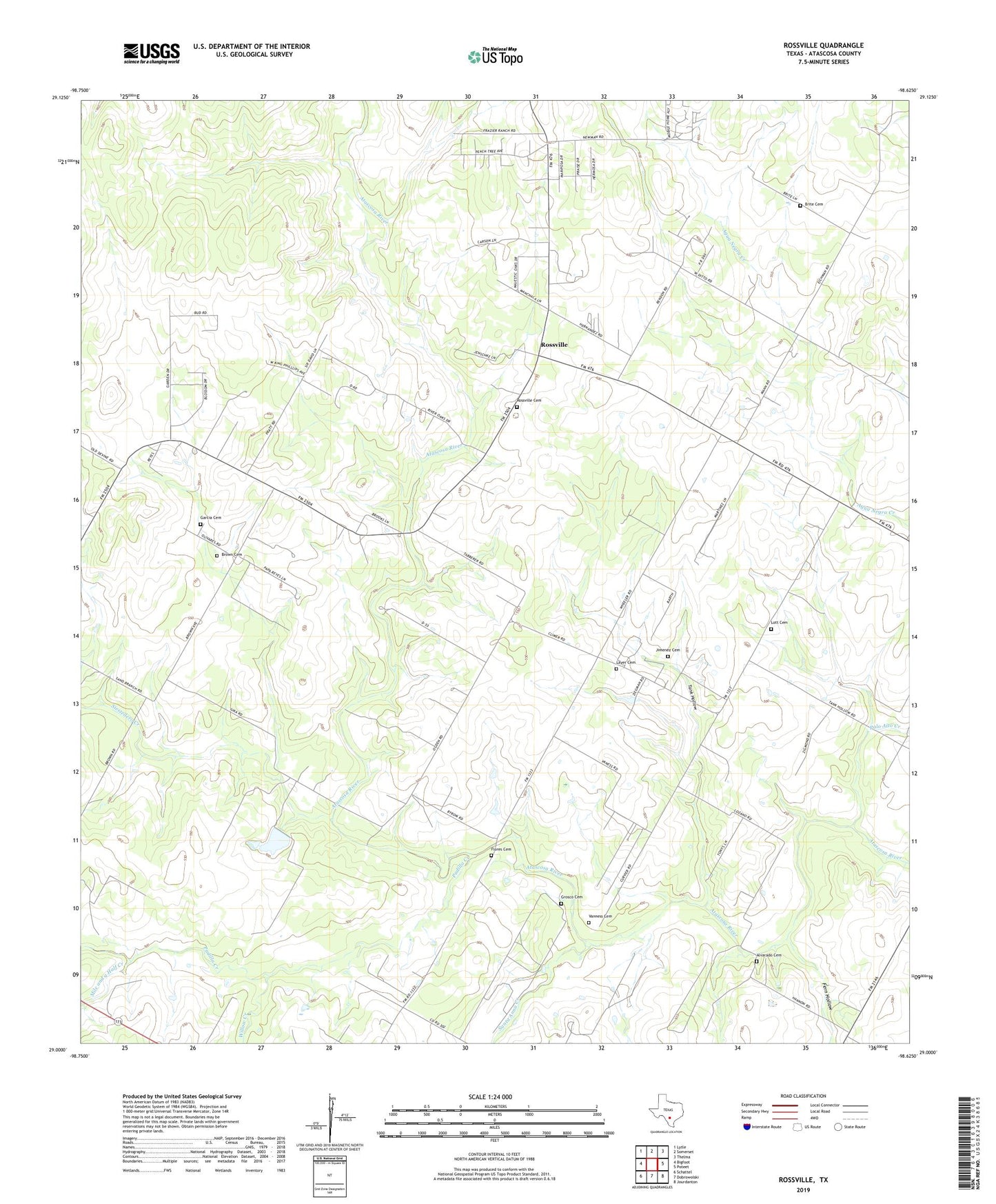
2022 topographic map quadrangle Rossville in the state of Texas. Scale: 1:24000. Based on the newly updated USGS 7.5' US Topo map series, this map is in the following counties: Atascosa. The map contains contour data, water features, and other items you are used to seeing on USGS maps, but also has updated roads and other features. This is the next generation of topographic maps. Printed on high-quality waterproof paper with UV fade-resistant inks.
Quads adjacent to this one:
West: Bigfoot
Northwest: Lytle
North: Somerset
Northeast: Thelma
East: Poteet
Southeast: Jourdanton
South: Dobrowolski
Southwest: Schattel
This map covers the same area as the classic USGS quad with code o29098a6.
Contains the following named places: Alvarado Cemetery, Anchorage, Brite Cemetery, Brown Cemetery, Fern Hollow, Flores Cemetery, Garcia Cemetery, Grosco Cemetery, Iuka, Jimenez Cemetery, Layer Cemetery, Lott Cemetery, Mile and a Half Creek, Padilla Creek, Palo Alto Creek, Poteet Division, Rossville, Rossville Cemetery, Santa Anna Creek, Siestedero Creek, Sue, Tank Hollow, Vanness Cemetery, Willow Creek, ZIP Code: 78065