MyTopo
Pleasanton Texas US Topo Map
Couldn't load pickup availability
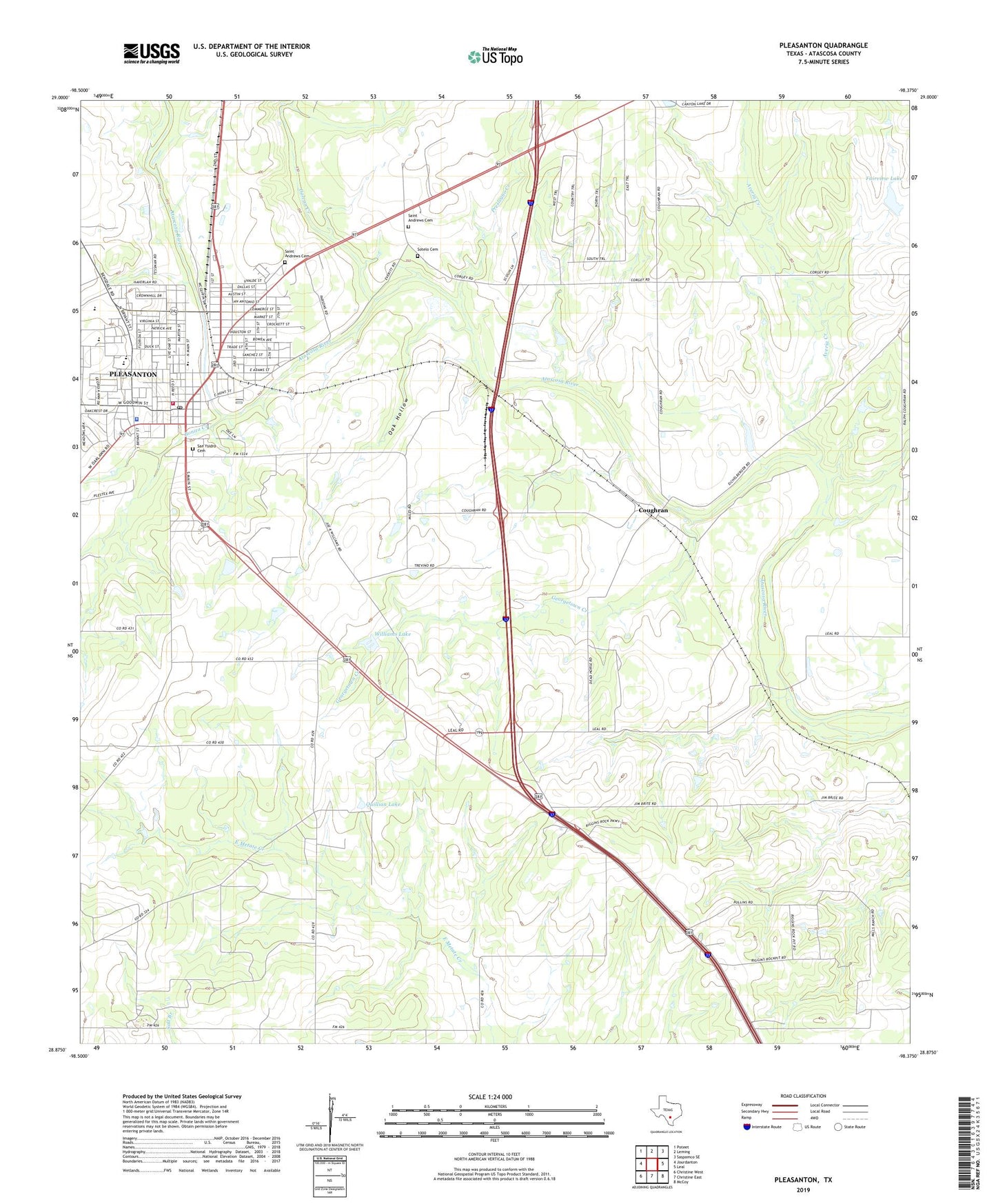
2022 topographic map quadrangle Pleasanton in the state of Texas. Scale: 1:24000. Based on the newly updated USGS 7.5' US Topo map series, this map is in the following counties: Atascosa. The map contains contour data, water features, and other items you are used to seeing on USGS maps, but also has updated roads and other features. This is the next generation of topographic maps. Printed on high-quality waterproof paper with UV fade-resistant inks.
Quads adjacent to this one:
West: Jourdanton
Northwest: Poteet
North: Leming
Northeast: Saspamco SE
East: Leal
Southeast: McCoy
South: Christine East
Southwest: Christine West
This map covers the same area as the classic USGS quad with code o28098h4.
Contains the following named places: Atascosa City Park, Atascosa County Emergency Medical Services, Atascosa Cowboy Recreation Center, Atascosa First Seventh Day Adventist Church, Atascosa River Park, Averia Creek, Bonita Creek, Church of Christ, City of Pleasanton, City Park, Community Bible Chapel Church, Coughran, Fairview Farms Dam, Fairview Lake, First Presbyterian Church, Galvan Creek, Georgetown Creek, Imogene Oil Field, Lyons Park, Oak Hollow, Pleasanton, Pleasanton City Hall, Pleasanton Division, Pleasanton Elementary School, Pleasanton High School, Pleasanton Intermediate School, Pleasanton Police Department, Pleasanton Post Office, Pleasanton Volunteer Fire Department, Presleano Creek, Primera Iglesia Bautista Church, Quality Ambulance Service, Quillian Dam, Quillian Lake, Rips Lake, Rips Lake Dam, Saint Andrew Catholic Church, Saint Andrews Cemetery, San Pedro Branch Library, San Ysidro Cemetery, Sotelo Cemetery, Texas Regional Emergency Medical Services, Thousand Oaks Library, Williams Dam, Williams Lake, ZIP Code: 78064