MyTopo
Jumbo Hill Texas US Topo Map
Couldn't load pickup availability
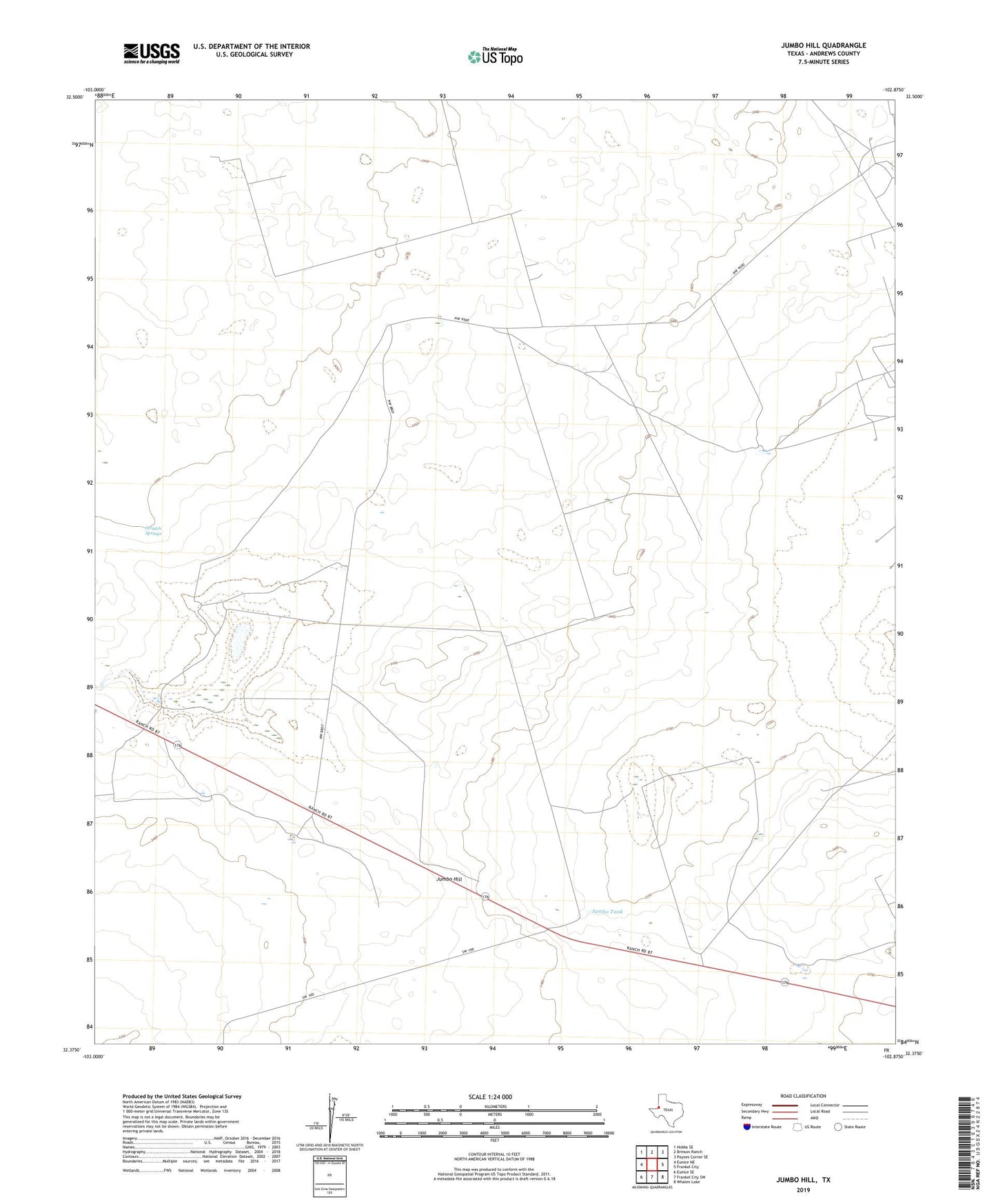
2022 topographic map quadrangle Jumbo Hill in the state of Texas. Scale: 1:24000. Based on the newly updated USGS 7.5' US Topo map series, this map is in the following counties: Andrews. The map contains contour data, water features, and other items you are used to seeing on USGS maps, but also has updated roads and other features. This is the next generation of topographic maps. Printed on high-quality waterproof paper with UV fade-resistant inks.
Quads adjacent to this one:
West: Eunice NE
Northwest: Hobbs SE
North: Brinson Ranch
Northeast: Paynes Corner SE
East: Frankel City
Southeast: Whalen Lake
South: Frankel City SW
Southwest: Eunice SE
This map covers the same area as the classic USGS quad with code o32102d8.
Contains the following named places: Flat Windmills, Harwell Windmill, Homesteader Windmill, Jumbo Hill, Jumbo Hill Windmill, Jumbo Tank, Kelly Windmill, McWhorter Cemetery, McWhorter Ranch, Moore Lake, Morgan Ranch, New Windmills, Scratch Springs, South Windmill