MyTopo
Keith Texas US Topo Map
Couldn't load pickup availability
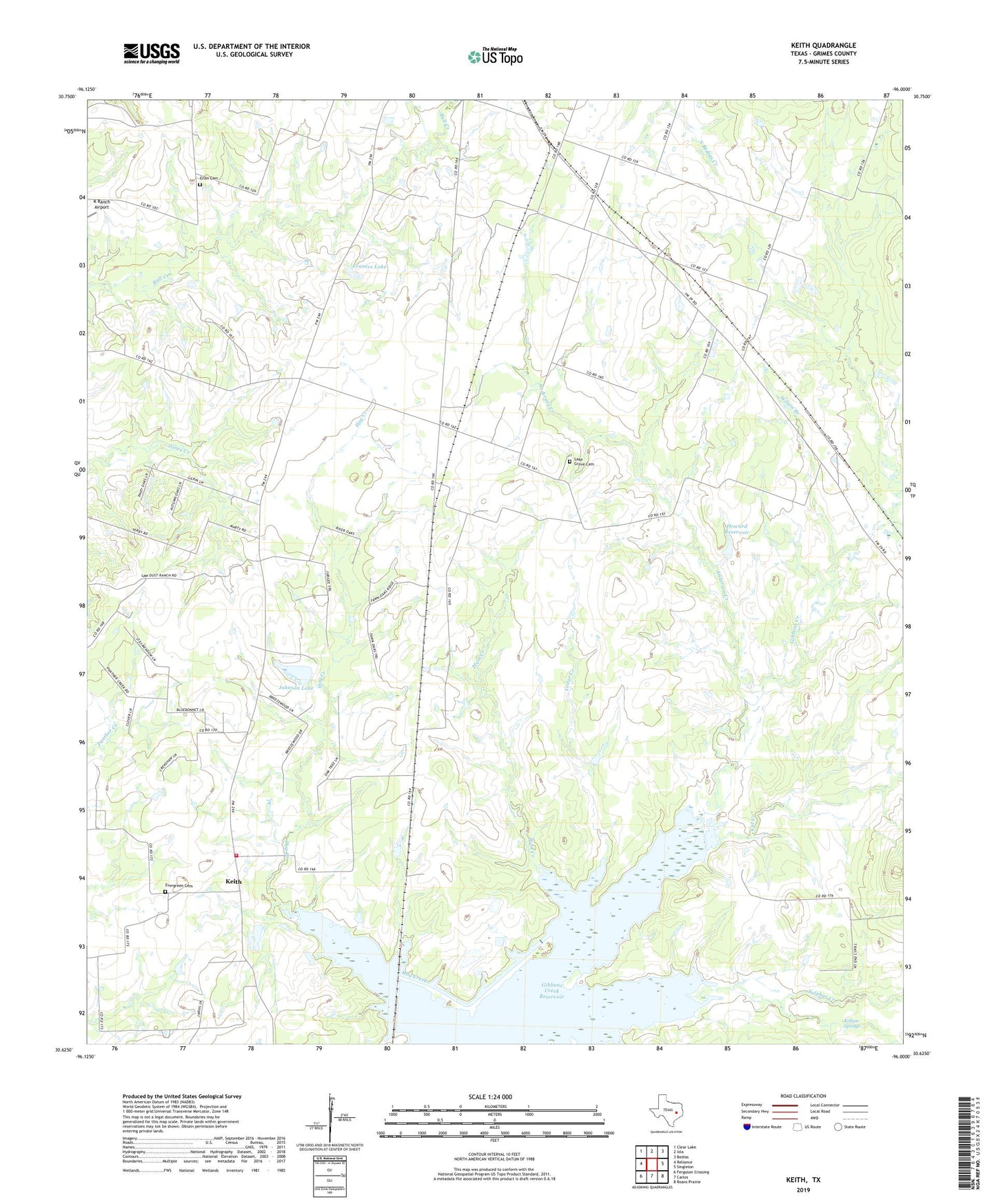
2019 topographic map quadrangle Keith in the state of Texas. Scale: 1:24000. Based on the newly updated USGS 7.5' US Topo map series, this map is in the following counties: Grimes. The map contains contour data, water features, and other items you are used to seeing on USGS maps, but also has updated roads and other features. This is the next generation of topographic maps. Printed on high-quality waterproof paper with UV fade-resistant inks.
Quads adjacent to this one:
West: Reliance
Northwest: Clear Lake
North: Iola
Northeast: Bedias
East: Singleton
Southeast: Roans Prairie
South: Carlos
Southwest: Ferguson Crossing
Contains the following named places: Anderson Creek, Cat Creek, Cedar Creek, Enon Cemetery, Evergreen Cemetery, Flying J Ranch, Frances Lake, Free Will Church, Gibbons Creek Reservoir, Howard Reservoir, Howard Reservoir Dam, Iola Volunteer Fire Department Station 2, Johnson Lake, Johnson Lake Dam, Keith, Kellum Springs, Lake Grove Cemetery, Plum Creek, Wilson Branch, ZIP Code: 77861