MyTopo
Carlos Texas US Topo Map
Couldn't load pickup availability
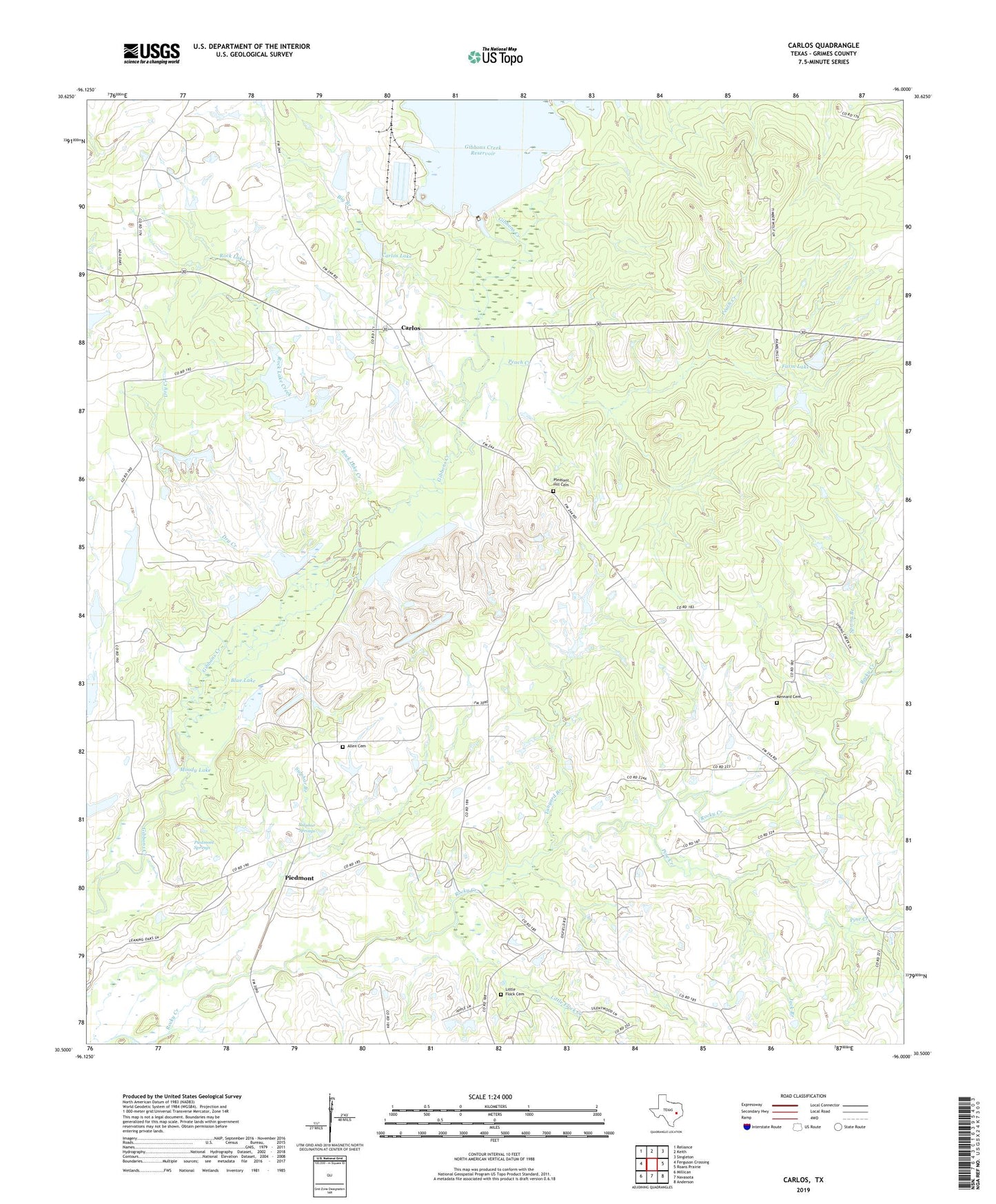
2022 topographic map quadrangle Carlos in the state of Texas. Scale: 1:24000. Based on the newly updated USGS 7.5' US Topo map series, this map is in the following counties: Grimes. The map contains contour data, water features, and other items you are used to seeing on USGS maps, but also has updated roads and other features. This is the next generation of topographic maps. Printed on high-quality waterproof paper with UV fade-resistant inks.
Quads adjacent to this one:
West: Ferguson Crossing
Northwest: Reliance
North: Keith
Northeast: Singleton
East: Roans Prairie
Southeast: Anderson
South: Navasota
Southwest: Millican
This map covers the same area as the classic USGS quad with code o30096e1.
Contains the following named places: Allen Cemetery, Anderson Grove Church, Big Branch, Blue Lake, Blue Lake Church, Carlos, Carlos Lake, Carlos Lake Dam, Dry Creek, Fanthorp Inn State Historical Park, Farm Lake, Farm Lake Dam, Gibbons Creek Dam, Hog Creek, Jack Branch, KBTX-TV (Bryan), Kennard Cemetery, Little Flock Cemetery, Little Flock Creek, Moody Lake, Moody Lake Dam, Peach Creek, Piedmont, Piedmont Springs, Pine Creek, Pleasant Hill Cemetery, Rock Lake Creek, Spring Branch, Sulphur Branch, Sulphur Creek, Sulphur Springs, Tanyard Branch, Waltrip Lake, Waltrip Lake Dam, ZIP Code: 77830