MyTopo
Ferguson Crossing Texas US Topo Map
Couldn't load pickup availability
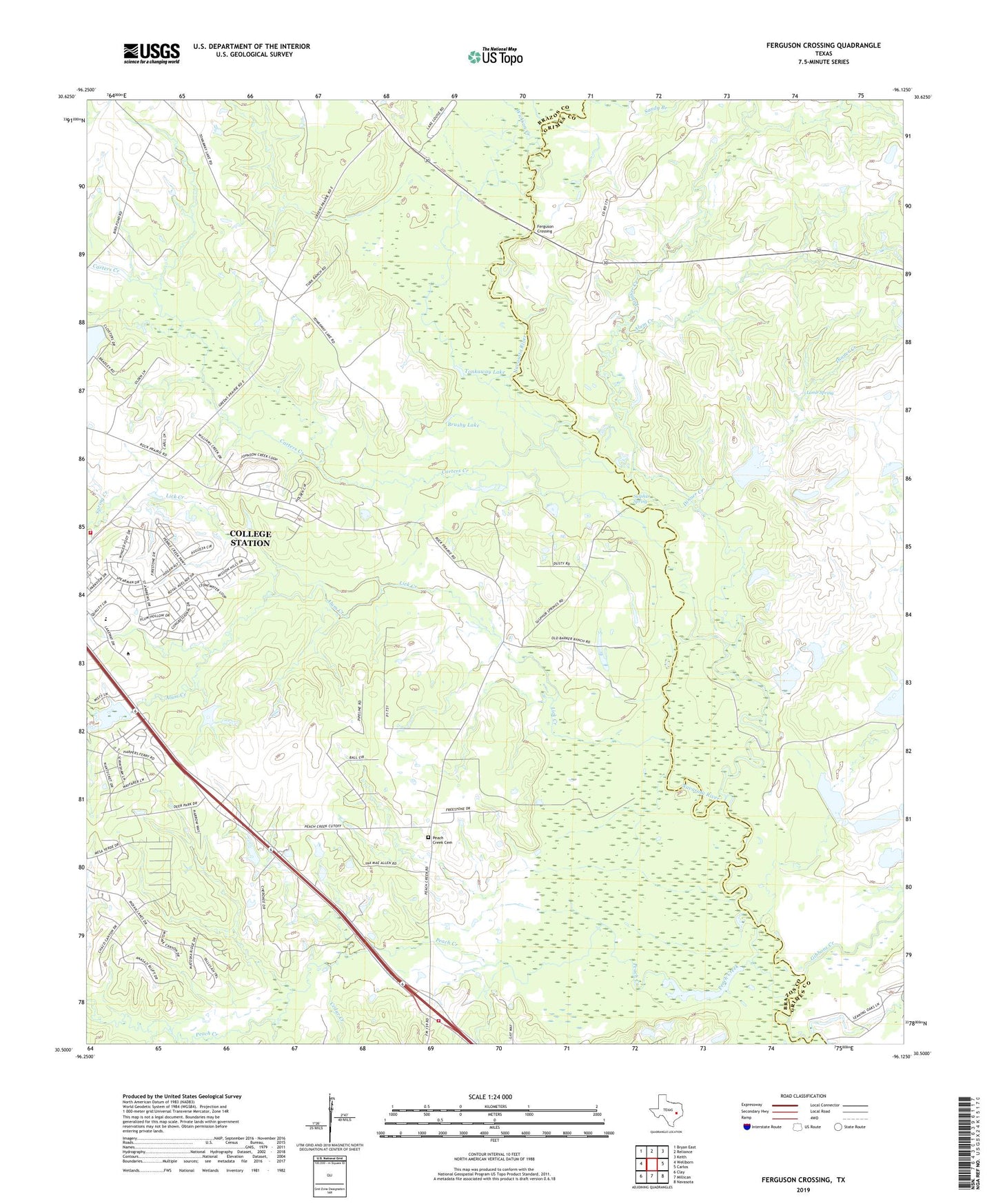
2022 topographic map quadrangle Ferguson Crossing in the state of Texas. Scale: 1:24000. Based on the newly updated USGS 7.5' US Topo map series, this map is in the following counties: Brazos, Grimes. The map contains contour data, water features, and other items you are used to seeing on USGS maps, but also has updated roads and other features. This is the next generation of topographic maps. Printed on high-quality waterproof paper with UV fade-resistant inks.
Quads adjacent to this one:
West: Wellborn
Northwest: Bryan East
North: Reliance
Northeast: Keith
East: Carlos
Southeast: Navasota
South: Millican
Southwest: Clay
This map covers the same area as the classic USGS quad with code o30096e2.
Contains the following named places: Alum Creek, Brushy Lake, Carter Lake, Carter Lake Dam, Carters Creek, Cedar Creek, College Station Fire Station 5, Dinner Creek, Ferguson Crossing, Gibbons Creek, Lamb Spring, Lick Creek, Panther Branch, Panther Creek, Peach Creek, Peach Creek Cemetery, Pebble Creek Elementary School, Sandy Branch, South Brazos County Fire Department Station 4, South Brazos Division, Spring Creek, Sulphur Spring, Texas World Speedway Helistop Number 1 Heliport, Texas World Speedway Helistop Number 2 Heliport, Tonkaway Lake, Wichman Lake, Wichman Lake Dam, Wickson Creek