MyTopo
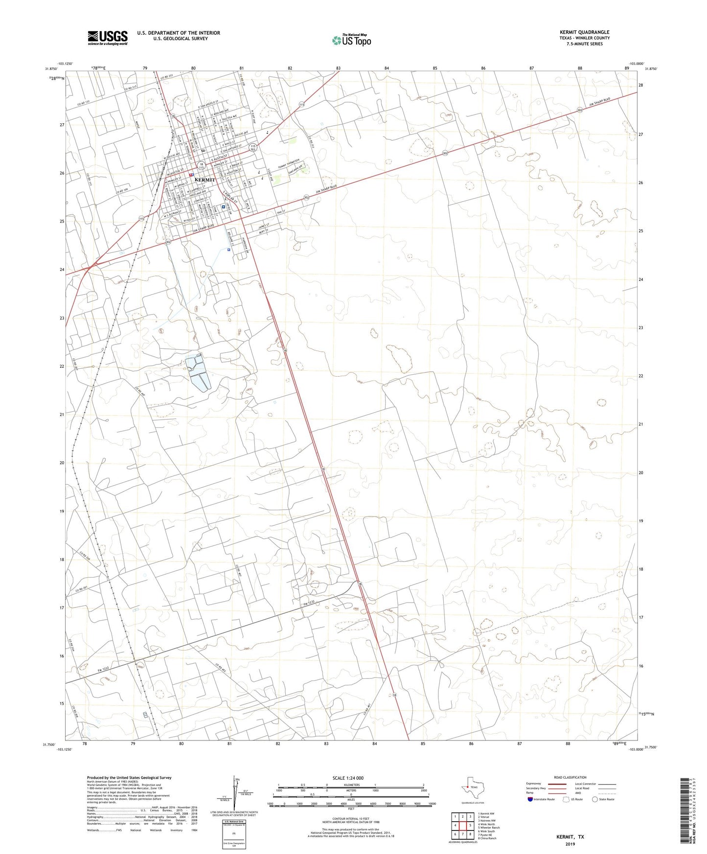
Kermit Texas US Topo Map
Couldn't load pickup availability
2022 topographic map quadrangle Kermit in the state of Texas. Scale: 1:24000. Based on the newly updated USGS 7.5' US Topo map series, this map is in the following counties: Winkler. The map contains contour data, water features, and other items you are used to seeing on USGS maps, but also has updated roads and other features. This is the next generation of topographic maps. Printed on high-quality waterproof paper with UV fade-resistant inks.
Quads adjacent to this one:
West: Wink North
Northwest: Kermit NW
North: Vesrue
Northeast: Notrees NW
East: Wheeler Ranch
Southeast: China Ranch
South: Pyote NE
Southwest: Wink South
This map covers the same area as the classic USGS quad with code o31103g1.
Contains the following named places: Auter Windmill, Church of Christ, Church of God, Church of God in Christ, City of Kermit, Community Church, Crawford Windmill, East Primary School, Hogg Windmill, Horse Windmill, Hugh Windmill, Kermit, Kermit Cemetery, Kermit City Hall, Kermit City Park, Kermit Elementary School, Kermit High School, Kermit Junior High School, Kermit Police Department, Kermit Post Office, Kermit Volunteer Fire Department, Kermit Windmill, Little Sand Windmill, Lowe Windmill, North Crow Windmill, Northside Baptist Church, Plaza Park, Purple Sage Elementary School, Robinson Airport, South Crow Windmill, South Rusk Windmill, South Sand Windmill, South Windmill, Two Section Windmill, Vest Windmill, Walton Park, Wieseman Windmill, Winkler County, Winkler County Constable's Office Precincts 2 and 4, Winkler County Emergency Medical Services, Winkler County Jail, Winkler County Memorial Hospital, Winkler County Park, Winkler County Sheriff's Office, ZIP Code: 79745