MyTopo
La Coste NE Texas US Topo Map
Couldn't load pickup availability
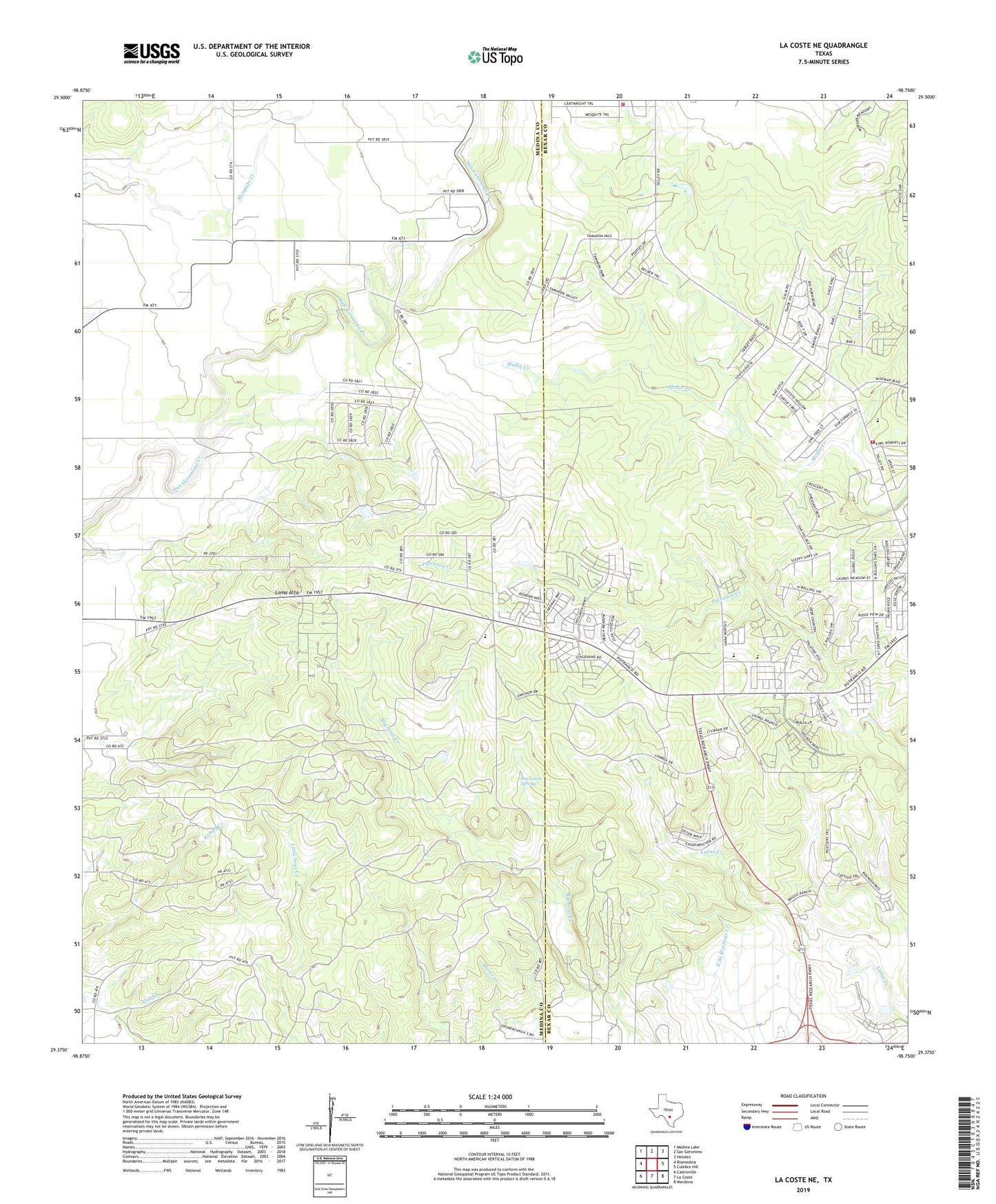
2019 topographic map quadrangle La Coste NE in the state of Texas. Scale: 1:24000. Based on the newly updated USGS 7.5' US Topo map series, this map is in the following counties: Medina, Bexar. The map contains contour data, water features, and other items you are used to seeing on USGS maps, but also has updated roads and other features. This is the next generation of topographic maps. Printed on high-quality waterproof paper with UV fade-resistant inks.
Quads adjacent to this one:
West: Riomedina
Northwest: Medina Lake
North: San Geronimo
Northeast: Helotes
East: Culebra Hill
Southeast: Macdona
South: La Coste
Southwest: Castroville
Contains the following named places: Big Sous Creek, Castroville-LaCoste Division, Geronimo Village Volunteer Fire Department Central Station, Geronimo Village Volunteer Fire Department Station 2, Loma Alta, San Lucas Springs, Talley Road Baptist Chapel Church, ZIP Code: 78253