
MyTopo
La Coste Texas US Topo Map
Couldn't load pickup availability
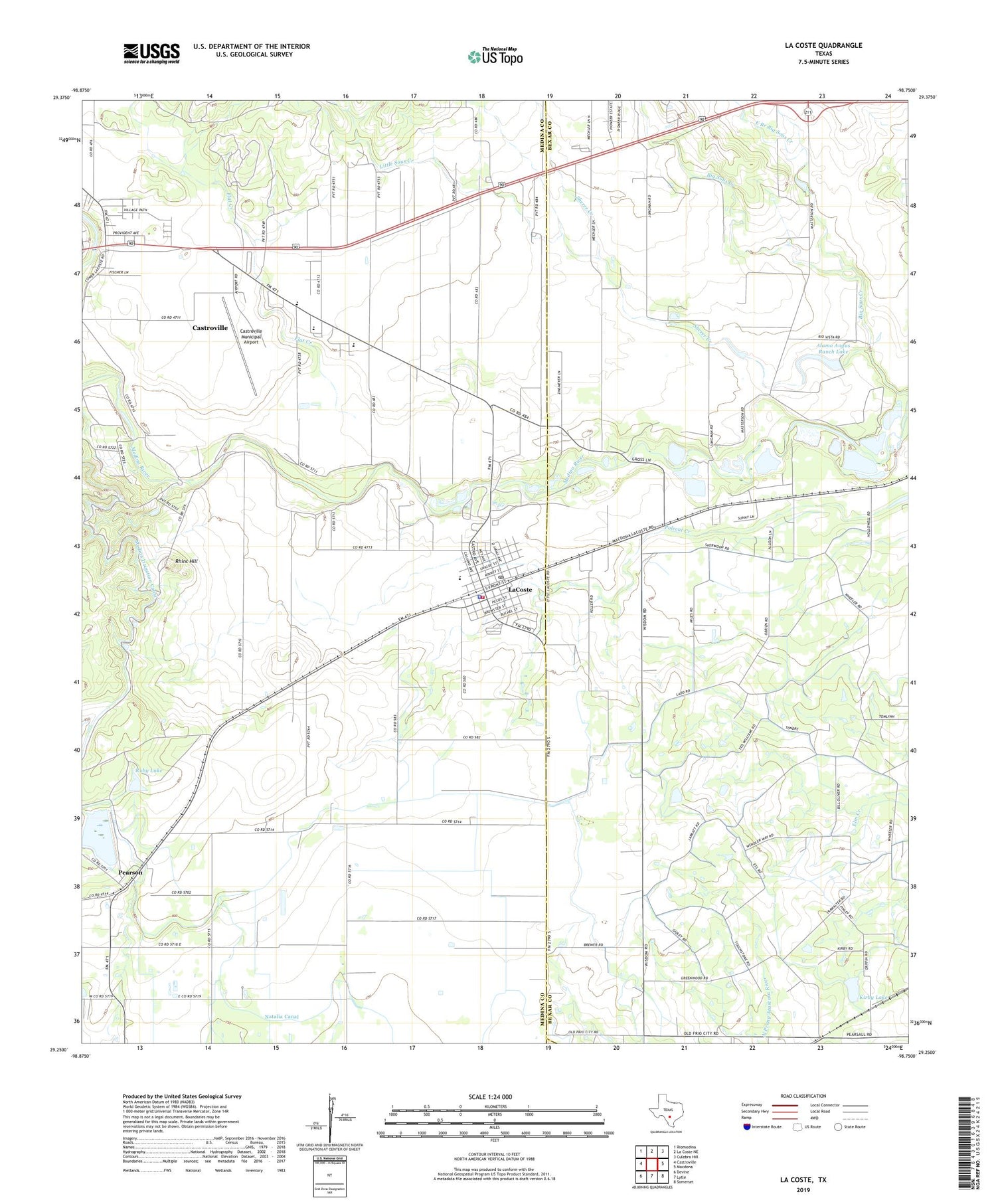
2022 topographic map quadrangle La Coste in the state of Texas. Scale: 1:24000. Based on the newly updated USGS 7.5' US Topo map series, this map is in the following counties: Medina, Bexar, Atascosa. The map contains contour data, water features, and other items you are used to seeing on USGS maps, but also has updated roads and other features. This is the next generation of topographic maps. Printed on high-quality waterproof paper with UV fade-resistant inks.
Quads adjacent to this one:
West: Castroville
Northwest: Riomedina
North: La Coste NE
Northeast: Culebra Hill
East: Macdona
Southeast: Somerset
South: Lytle
Southwest: Devine
This map covers the same area as the classic USGS quad with code o29098c7.
Contains the following named places: Alamo Angus Ranch Lake, Alamo Angus Ranch Lake Dam, Castroville Historic District, Castroville Municipal Airport, City of Castroville, City of LaCoste, East Branch Big Sous Creek, Flat Creek, Kirby Lake, Kirby Lake Dam, La Coste, La Coste City Hall, La Coste Volunteer Fire Department, LaCoste Police Department, LaCoste Post Office, Landmark Inn Complex, Little Sous Creek, Lytle Airpark, Medina County Constable's Office Precinct 2, Medina Valley Alternative Learning Center, Medina Valley High School, Medina Valley Junior High School, Our Lady of Grace School, Pearson, Rhins Hill, Ruby Lake, Sherer Creek, ZIP Code: 78039


