MyTopo
Castroville Texas US Topo Map
Couldn't load pickup availability
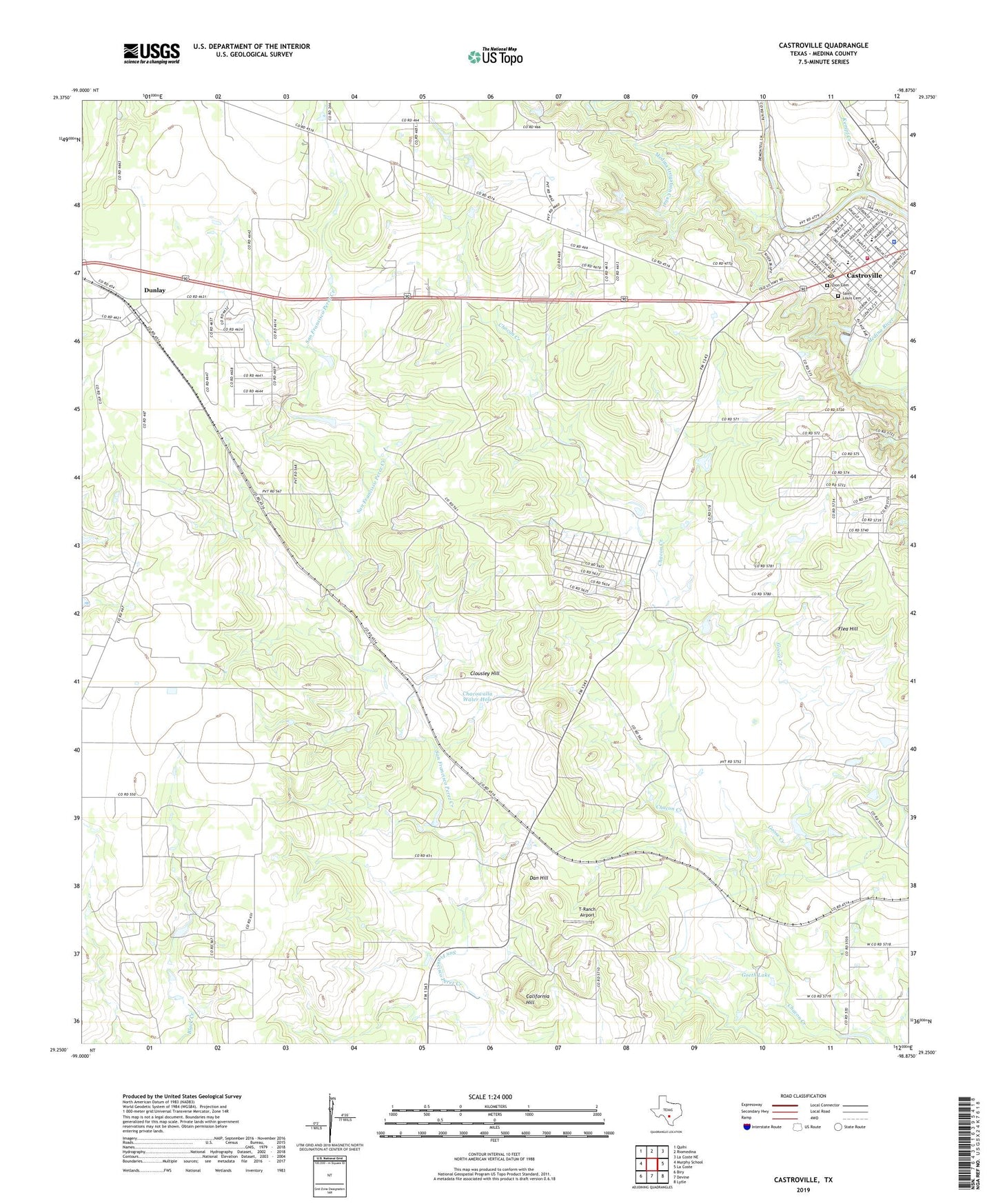
2022 topographic map quadrangle Castroville in the state of Texas. Scale: 1:24000. Based on the newly updated USGS 7.5' US Topo map series, this map is in the following counties: Medina. The map contains contour data, water features, and other items you are used to seeing on USGS maps, but also has updated roads and other features. This is the next generation of topographic maps. Printed on high-quality waterproof paper with UV fade-resistant inks.
Quads adjacent to this one:
West: Murphy School
Northwest: Quihi
North: Riomedina
Northeast: La Coste NE
East: La Coste
Southeast: Lytle
South: Devine
Southwest: Biry
This map covers the same area as the classic USGS quad with code o29098c8.
Contains the following named places: Bader, Brownwood Public Library, California Hill, Castroville, Castroville City Hall, Castroville Community Cemetery, Castroville Police Department, Castroville Post Office, Castroville Volunteer Fire Department, Chacowalla Water Hole, Charles de Montel House, Clousley Hill, Dan Hill, Dunlay, Flea Hill, Goeth Lake, Goeth Lake Dam, Goose Creek, Kempf Creek, Koenig Park, Medina Irrigation Canal, Medina Valley Elementary School, Medina Valley Emergency Medical Service, Medina Valley School, Noonan, Regional Park, Saint Louis Cemetery, T-Ranch Airport, Zion Cemetery, ZIP Code: 78009