MyTopo
La Grange East Texas US Topo Map
Couldn't load pickup availability
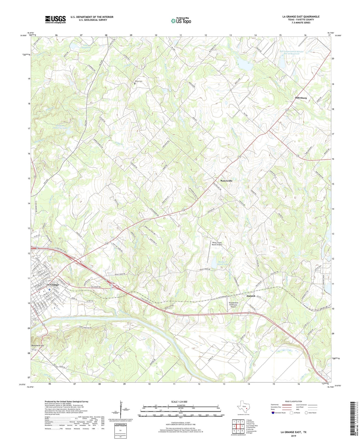
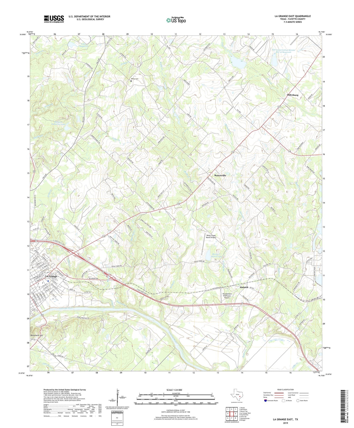
2019 topographic map quadrangle La Grange East in the state of Texas. Scale: 1:24000. Based on the newly updated USGS 7.5' US Topo map series, this map is in the following counties: Fayette. The map contains contour data, water features, and other items you are used to seeing on USGS maps, but also has updated roads and other features. This is the next generation of topographic maps. Printed on high-quality waterproof paper with UV fade-resistant inks.
Quads adjacent to this one:
West: La Grange West
Northwest: Warda
North: Nechanitz
Northeast: Round Top
East: Fayetteville
Southeast: Ellinger
South: Ammannsville
Southwest: Swiss Alp
Contains the following named places: Air Evac 47, Blue Branch, Cedar Creek, Cedar Grove Church, Double D Farms Airport, Farmers Industries Dam, Farmers Industries Lake, Fayette County Emergency Medical Services, Fayette Heritage Museum and Archives, Gay Hill, Gravelly Branch, Halsted, Henry L Kreische Brewery and House, Hermes Elementary School, Hermes School, High Hill Creek, Joiner, KBUK-FM (La Grange), Kiest Branch Library, KVLG-AM (La Grange), La Grange High School, La Grange Intermediate School, La Grange Magnetic Station, La Grange Middle School, La Grange Police Department, Lake Chapparal, Lake Chapparal Dam, Lester Park, Lone Star Camp, Lower Colorado River Authority - Fayette Power Project, Lutherhill Camp, Martin Luther King Junior Library, Moore Cemetery, N W Faison Home and Museum, North Oak Cliff Branch Library, Oak Lawn Branch Library, Oldenburg, Park, Park Forest Branch Library, Post Oak Church, Randolph High School, Rocky Creek, Rocky Creek Ranch Airport, Rocky Creek Ranch Lake, Rocky Creek Ranch Lake Dam, Rutersville, Saint James Episcopal Church, Saint Johns Church, Saint Matthews Church, Soil Conservation Service Site 21 Dam, Soil Conservation Service Site 21 Reservoir, Soil Conservation Service Site 22 Dam, Soil Conservation Service Site 22 Reservoir, Texas Forest Service - LaGrange Office, Thunderbird Southwest Airport, Wertzner Creek