MyTopo
Warda Texas US Topo Map
Couldn't load pickup availability
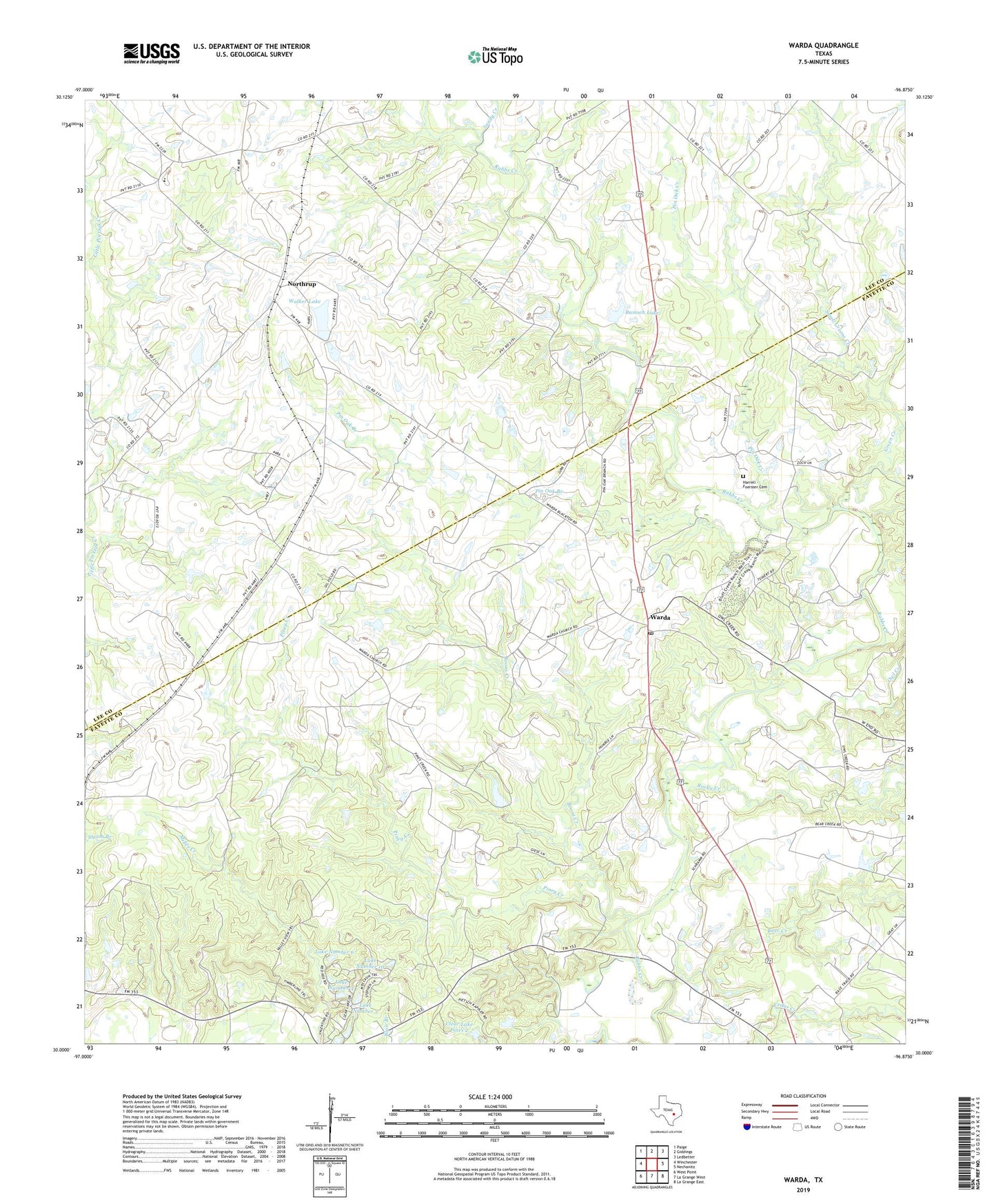
2022 topographic map quadrangle Warda in the state of Texas. Scale: 1:24000. Based on the newly updated USGS 7.5' US Topo map series, this map is in the following counties: Fayette, Lee. The map contains contour data, water features, and other items you are used to seeing on USGS maps, but also has updated roads and other features. This is the next generation of topographic maps. Printed on high-quality waterproof paper with UV fade-resistant inks.
Quads adjacent to this one:
West: Winchester
Northwest: Paige
North: Giddings
Northeast: Ledbetter
East: Nechanitz
Southeast: La Grange East
South: La Grange West
Southwest: West Point
This map covers the same area as the classic USGS quad with code o30096a8.
Contains the following named places: Bamsch Lake, Bamsch Lake Dam, Bear Creek, Boons Creek, Clear Lake Pines 2, Clear Lake Pines Dam 2, Clear Lake Pines Incorporated Dam Number 10, Clear Lake Pines Incorporated Dam Number 3, Clear Lake Pines Incorporated Dam Number 4, Clear Lake Pines Incorporated Dam Number 6, Foerster Cemetery, Green Creek, Holy Cross School, Lake Number 10, Lake Number 3, Lake Number 4, Lake Number 6, Lee County Jail, Little Pin Oak Creek, Northrup, Owl Creek, Pin Oak Branch, Pin Oak Creek, Piney Creek, Rocky Creek, Saint Paul Church, Sandy Creek, Small Greens Creek, Southwest Branch Library, Valley Ranch Branch Library, Walker Lake, Walker Lake Dam, Warda, Warda Post Office, William T Cozby Public Library, Zula B Wylie Library