MyTopo
La Ward Texas US Topo Map
Couldn't load pickup availability
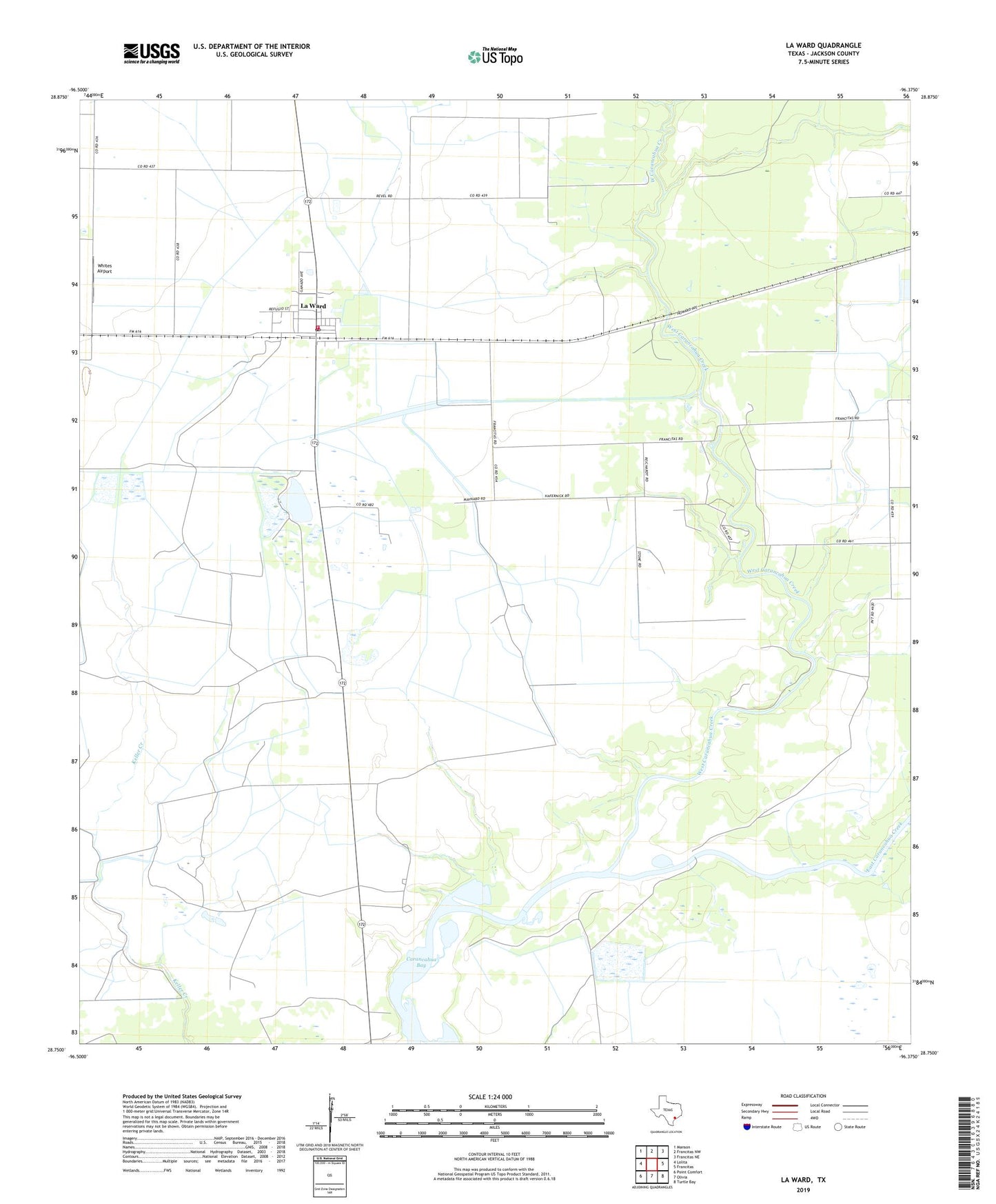
2019 topographic map quadrangle La Ward in the state of Texas. Scale: 1:24000. Based on the newly updated USGS 7.5' US Topo map series, this map is in the following counties: Jackson. The map contains contour data, water features, and other items you are used to seeing on USGS maps, but also has updated roads and other features. This is the next generation of topographic maps. Printed on high-quality waterproof paper with UV fade-resistant inks.
Quads adjacent to this one:
West: Lolita
Northwest: Manson
North: Francitas NW
Northeast: Francitas NE
East: Francitas
Southeast: Turtle Bay
South: Olivia
Southwest: Point Comfort
Contains the following named places: Brown-Dorsey Medallion Home, City of La Ward, East Carancahua Creek, La Ward, La Ward City Marshal's Office, La Ward Fire Department, La Ward Post Office, La Ward-Lolita Division, Laward Elementary School, Lunis Creek, West Carancahua Creek, Whites Airport, ZIP Code: 77970