MyTopo
Lolita Texas US Topo Map
Couldn't load pickup availability
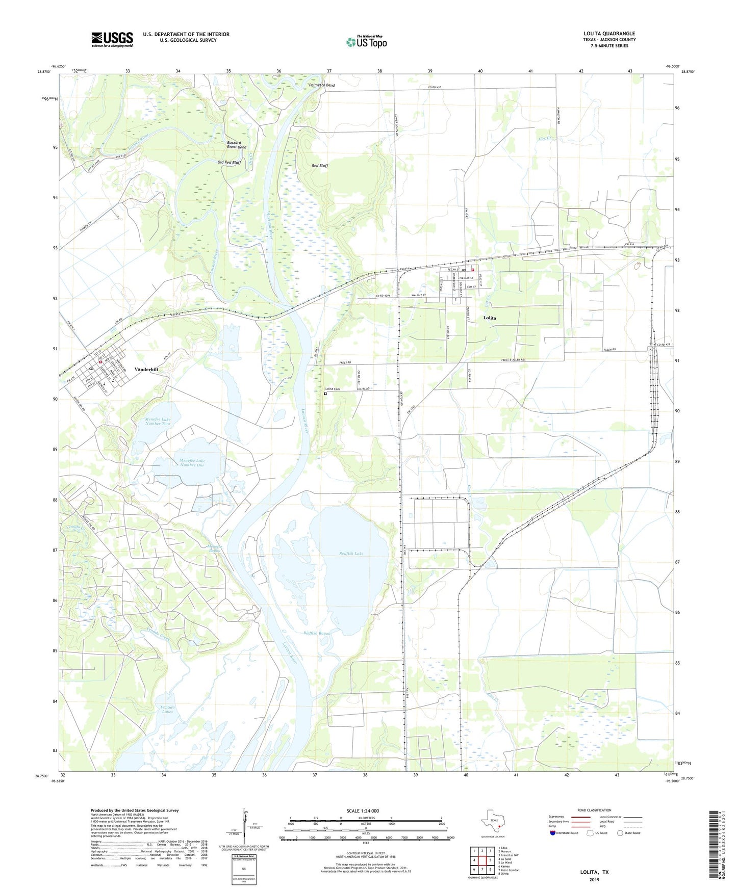
2022 topographic map quadrangle Lolita in the state of Texas. Scale: 1:24000. Based on the newly updated USGS 7.5' US Topo map series, this map is in the following counties: Jackson. The map contains contour data, water features, and other items you are used to seeing on USGS maps, but also has updated roads and other features. This is the next generation of topographic maps. Printed on high-quality waterproof paper with UV fade-resistant inks.
Quads adjacent to this one:
West: La Salle
Northwest: Edna
North: Manson
Northeast: Francitas NW
East: La Ward
Southeast: Olivia
South: Point Comfort
Southwest: Kamey
This map covers the same area as the classic USGS quad with code o28096g5.
Contains the following named places: Buzzard Roost Bend, Dry Creek, Industrial High School, Industrial Junior High School, KAVU-TV (Victoria), Lolita, Lolita Cemetery, Lolita Census Designated Place, Lolita Post Office, Lolita Volunteer Fire Department and Emergency Medical Services, Menefee Bayou, Menefee Flat, Menefee Lake Number One, Menefee Lake Number Two, Navidad River, Old Red Bluff, Palmetto Bend, Red Bluff, Redfish Bayou, Redfish Lake, Vanderbilt, Vanderbilt Census Designated Place, Vanderbilt Elementary School, Vanderbilt Post Office, Vanderbilt Volunteer Fire Department, Venado Creek, ZIP Codes: 77971, 77991