MyTopo
Point Comfort Texas US Topo Map
Couldn't load pickup availability
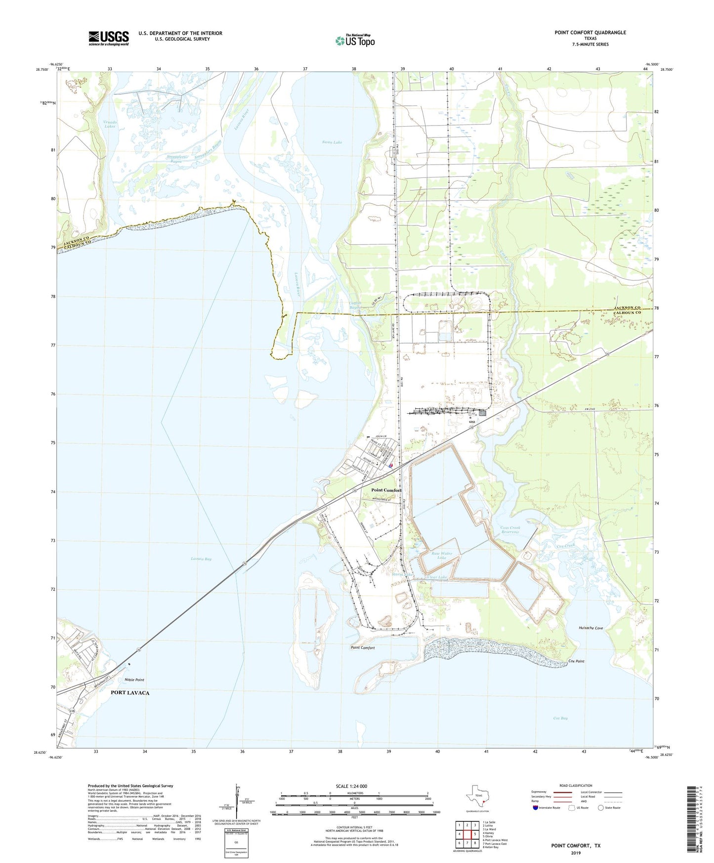
2022 topographic map quadrangle Point Comfort in the state of Texas. Scale: 1:24000. Based on the newly updated USGS 7.5' US Topo map series, this map is in the following counties: Calhoun, Jackson. The map contains contour data, water features, and other items you are used to seeing on USGS maps, but also has updated roads and other features. This is the next generation of topographic maps. Printed on high-quality waterproof paper with UV fade-resistant inks.
Quads adjacent to this one:
West: Kamey
Northwest: La Salle
North: Lolita
Northeast: La Ward
East: Olivia
Southeast: Keller Bay
South: Port Lavaca East
Southwest: Port Lavaca West
This map covers the same area as the classic USGS quad with code o28096f5.
Contains the following named places: Catfish Bayou, City of Point Comfort, Clear Lake, Clear Lake Levee, Cox Bay, Cox Creek, Cox Point, Coxs Creek Dam, Coxs Creek Reservoir, Dredge Spoil Lake, Dredge Spoil Lake Levee, Evaporation Lake, Evaporation Lake Dam, Evaporation Lake Number 1, Evaporation Lake Number 1 Levee, Evaporation Lake Number 2, Evaporation Lake Number 2 Levee, Evaporation Lake Number 3, Evaporation Lake Number 3 Levee, Fishing Pier Park, Huisache Cove, Lavaca Bay, Lavaca Causeway Marina, Lavaca River, Mud Lake Number 4, Mud Lake Number 4 Levee, Noble Point, Point Comfort, Point Comfort City Hall, Point Comfort Police Department, Point Comfort Post Office, Point Comfort Volunteer Fire Department, Port Comfort Elementary School, Raw Water Lake, Raw Water Lake Levee, Smugglers Bayou, Storm Lake, Storm Lake Levee, Swam Lake Oil Field, Swan Lake, Venado Lakes, ZIP Code: 77978