MyTopo
Laguna Del Toro Texas US Topo Map
Couldn't load pickup availability
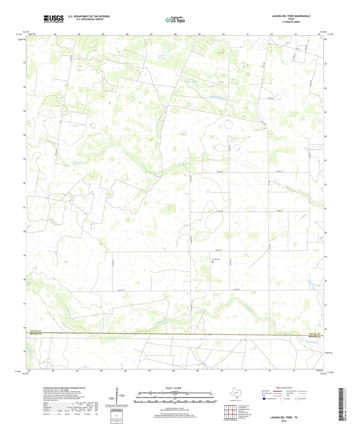
2019 topographic map quadrangle Laguna Del Toro in the state of Texas. Scale: 1:24000. Based on the newly updated USGS 7.5' US Topo map series, this map is in the following counties: Duval, Brooks. The map contains contour data, water features, and other items you are used to seeing on USGS maps, but also has updated roads and other features. This is the next generation of topographic maps. Printed on high-quality waterproof paper with UV fade-resistant inks.
Quads adjacent to this one:
West: Ramirez
Northwest: Concepcion NW
North: Concepcion
Northeast: Seeligson Ranch
East: Premont West
Southeast: Falfurrias
South: Palomas Ranch
Southwest: Palomas Ranch NW
Contains the following named places: Castor Windmill, Cibolo Ranch, Cibolo Windmill, Copita Cemetery, East Sejita Oil Field, Huisache Windmill, Iglesia Adventista del Septimo Dia, Ingleses Windmill, Laborcitas Windmill, Laguna del Toro, Laguna Grande, Llano Windmill, Louisiana Windmill, Novillo Windmill, Nuevo Windmill, Numero Uno Windmill, Pita Windmill, Preza Windmill, Rancho Vejo Windmill, Retema Windmill, Santa Pentecostes Church, Teneja Windmill, ZIP Code: 78349