MyTopo
Concepcion Texas US Topo Map
Couldn't load pickup availability
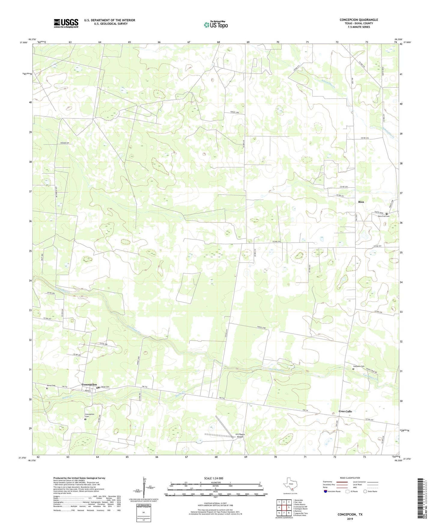
2022 topographic map quadrangle Concepcion in the state of Texas. Scale: 1:24000. Based on the newly updated USGS 7.5' US Topo map series, this map is in the following counties: Duval. The map contains contour data, water features, and other items you are used to seeing on USGS maps, but also has updated roads and other features. This is the next generation of topographic maps. Printed on high-quality waterproof paper with UV fade-resistant inks.
Quads adjacent to this one:
West: Concepcion NW
Northwest: Benavides
North: San Jose
Northeast: Palito Blanco
East: Seeligson Ranch
Southeast: Premont West
South: Laguna Del Toro
Southwest: Ramirez
This map covers the same area as the classic USGS quad with code o27098d3.
Contains the following named places: 4-G Ranch Airport, Concepcion, Concepcion Census Designated Place, Concepcion Creek, Concepcion Post Office, Conception, Conception Cemetery, Cruz Calle, Gonzales Cemetery, North Concepcion Oil Field, Perez Cemetery, Rios, Salinas Cemetery, San Manuel Cemetery, Santa Cruz, Velas Cemetery, Vera Cruz, Vera Cruz Cemetery