MyTopo
Lake Stamford West Texas US Topo Map
Couldn't load pickup availability
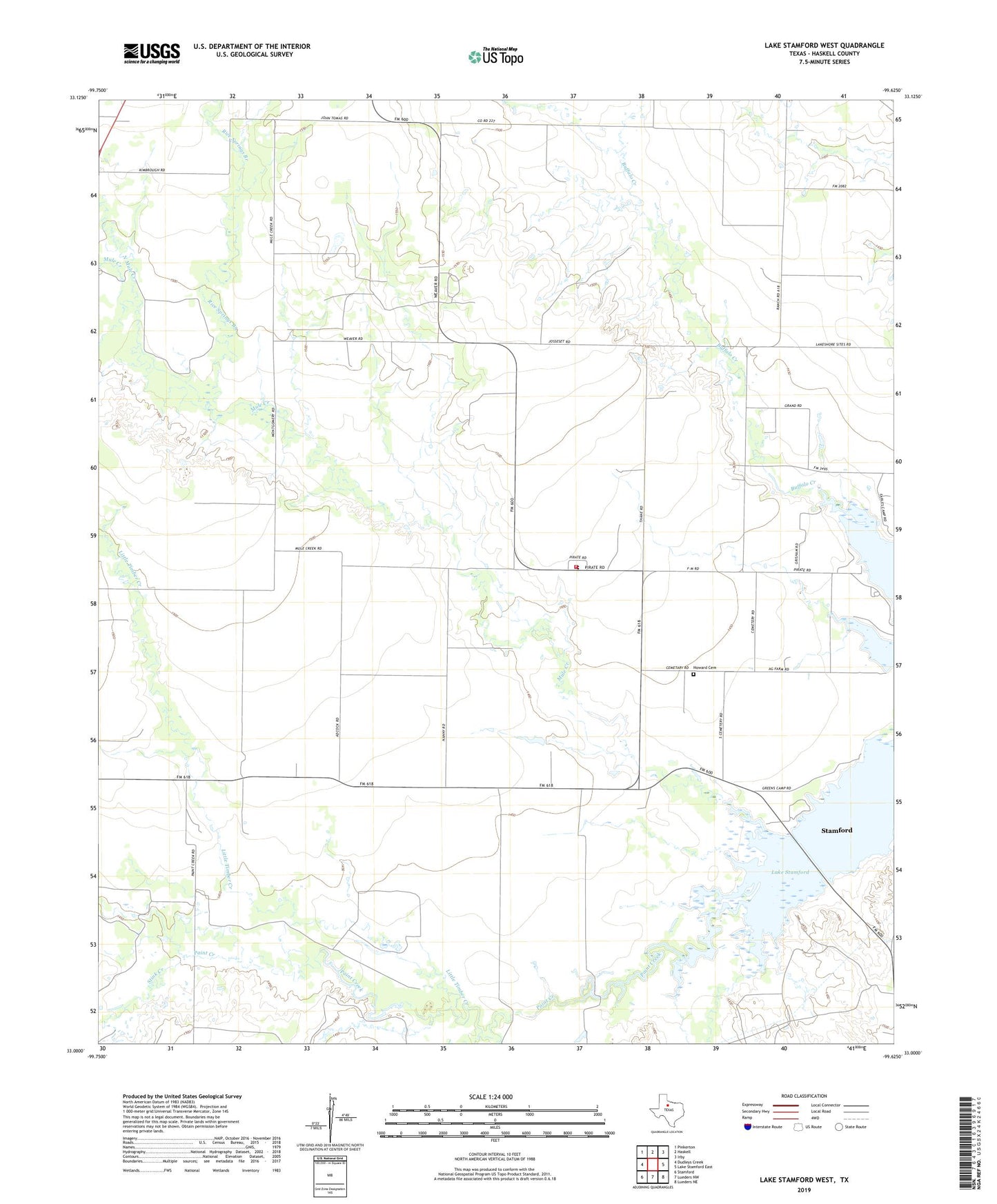
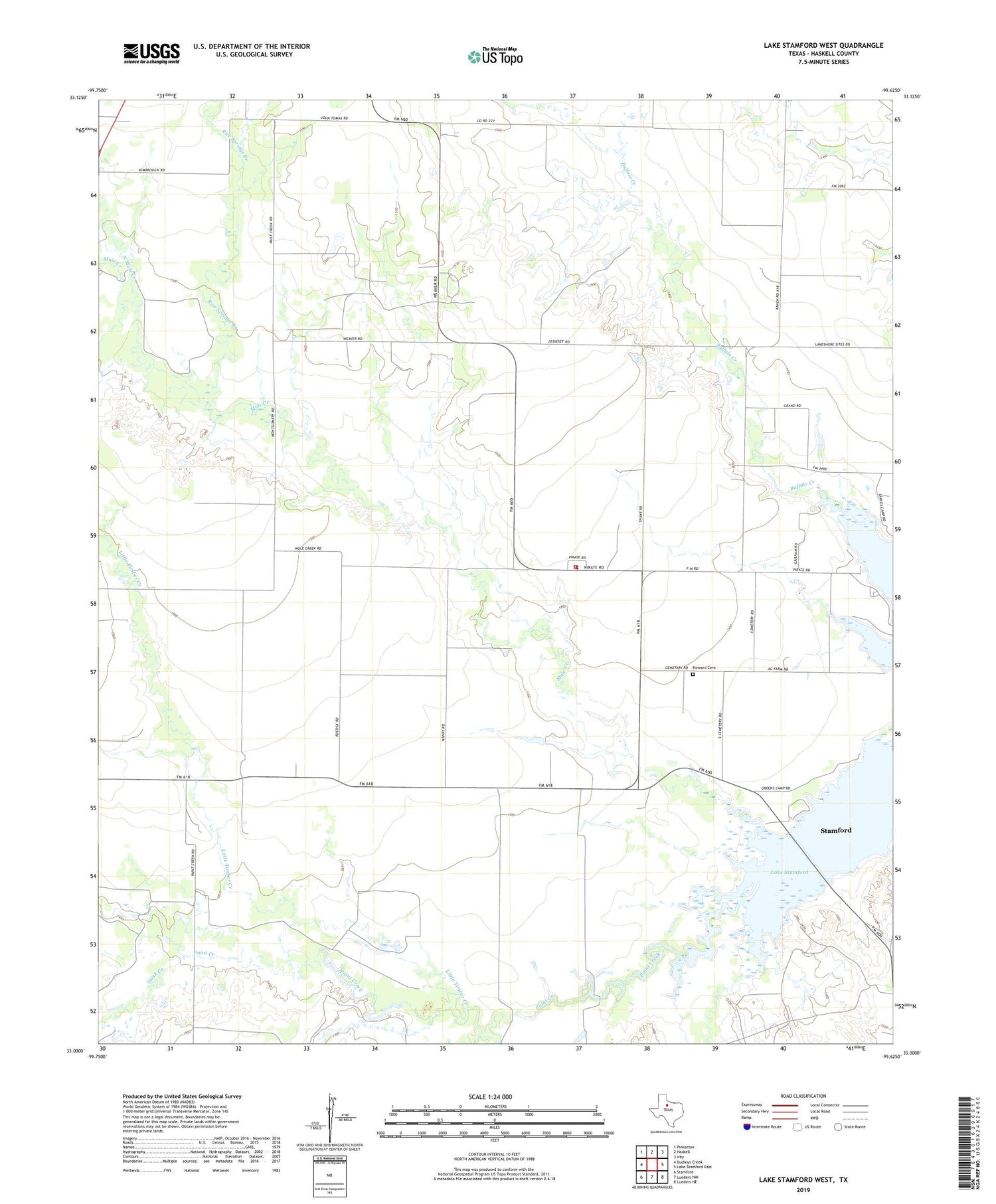
2019 topographic map quadrangle Lake Stamford West in the state of Texas. Scale: 1:24000. Based on the newly updated USGS 7.5' US Topo map series, this map is in the following counties: Haskell. The map contains contour data, water features, and other items you are used to seeing on USGS maps, but also has updated roads and other features. This is the next generation of topographic maps. Printed on high-quality waterproof paper with UV fade-resistant inks.
Quads adjacent to this one:
West: Dudleys Creek
Northwest: Pinkerton
North: Haskell
Northeast: Irby
East: Lake Stamford East
Southeast: Lueders NE
South: Lueders NW
Southwest: Stamford
Contains the following named places: Buffalo Creek, Flat Paint Creek, Haskell Oil Field, Howard Cemetery, Little Timber Creek, Mule Creek, North Mule Creek, Paint Creek, Paint Creek Volunteer Fire Department, Rice Springs Branch, Stink Creek, ZIP Code: 79521