MyTopo
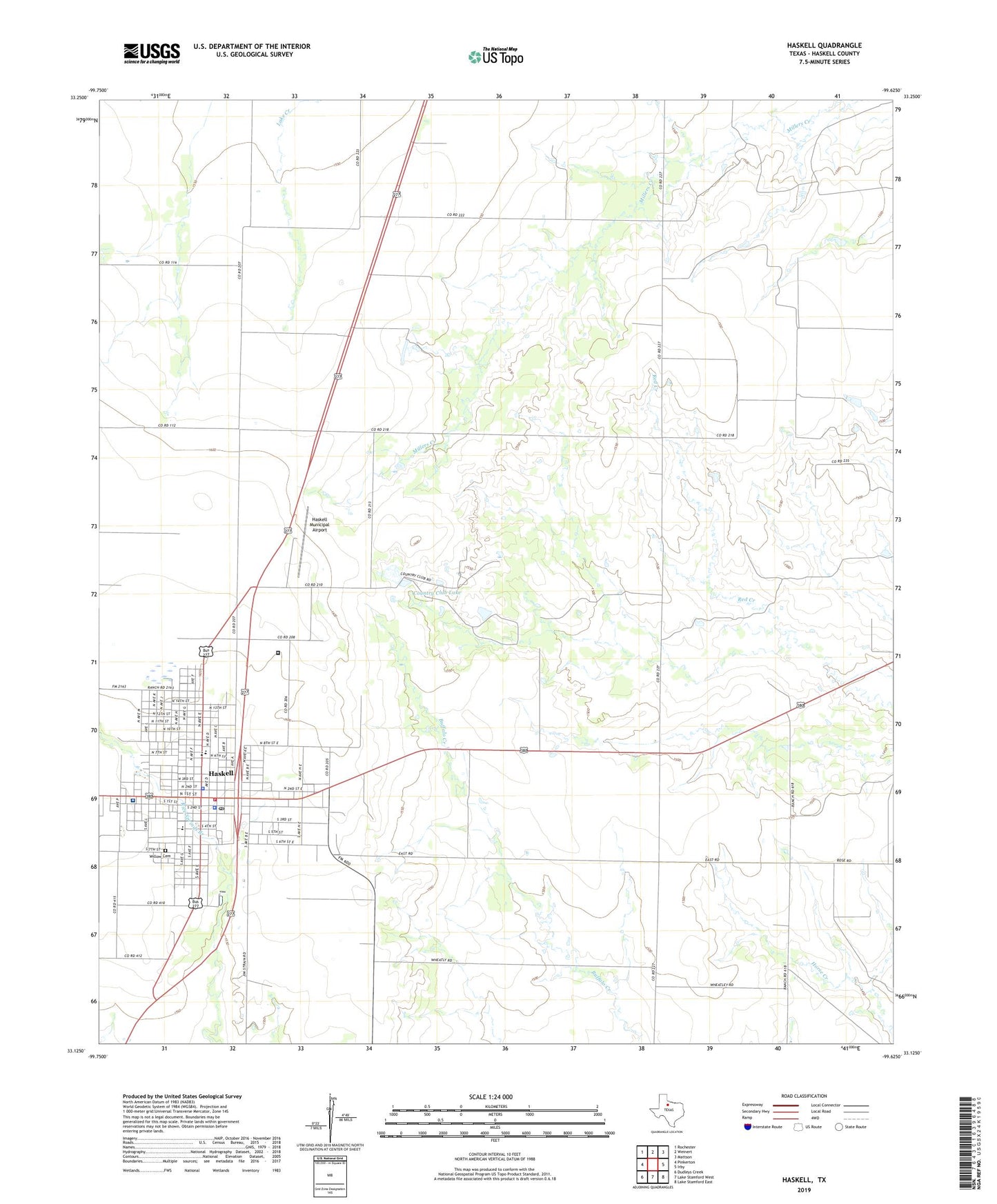
Haskell Texas US Topo Map
Couldn't load pickup availability
2022 topographic map quadrangle Haskell in the state of Texas. Scale: 1:24000. Based on the newly updated USGS 7.5' US Topo map series, this map is in the following counties: Haskell. The map contains contour data, water features, and other items you are used to seeing on USGS maps, but also has updated roads and other features. This is the next generation of topographic maps. Printed on high-quality waterproof paper with UV fade-resistant inks.
Quads adjacent to this one:
West: Pinkerton
Northwest: Rochester
North: Weinert
Northeast: Mattson
East: Irby
Southeast: Lake Stamford East
South: Lake Stamford West
Southwest: Dudleys Creek
This map covers the same area as the classic USGS quad with code o33099b6.
Contains the following named places: Church of Christ, Church of God, City of Haskell, Country Club Lake, Fields Museum, First Baptist Church, First Presbyterian Church, Greater Independent Baptist Church, Haskell, Haskell City Hall, Haskell Club Dam, Haskell County, Haskell County Ambulance Service, Haskell County Sheriff's Office, Haskell Elementary School, Haskell High School, Haskell Memorial Hospital, Haskell Municipal Airport, Haskell Police Department, Haskell Post Office, Haskell Volunteer Fire Department, Josselet, Willow Cemetery