MyTopo
Lake Stamford East Texas US Topo Map
Couldn't load pickup availability
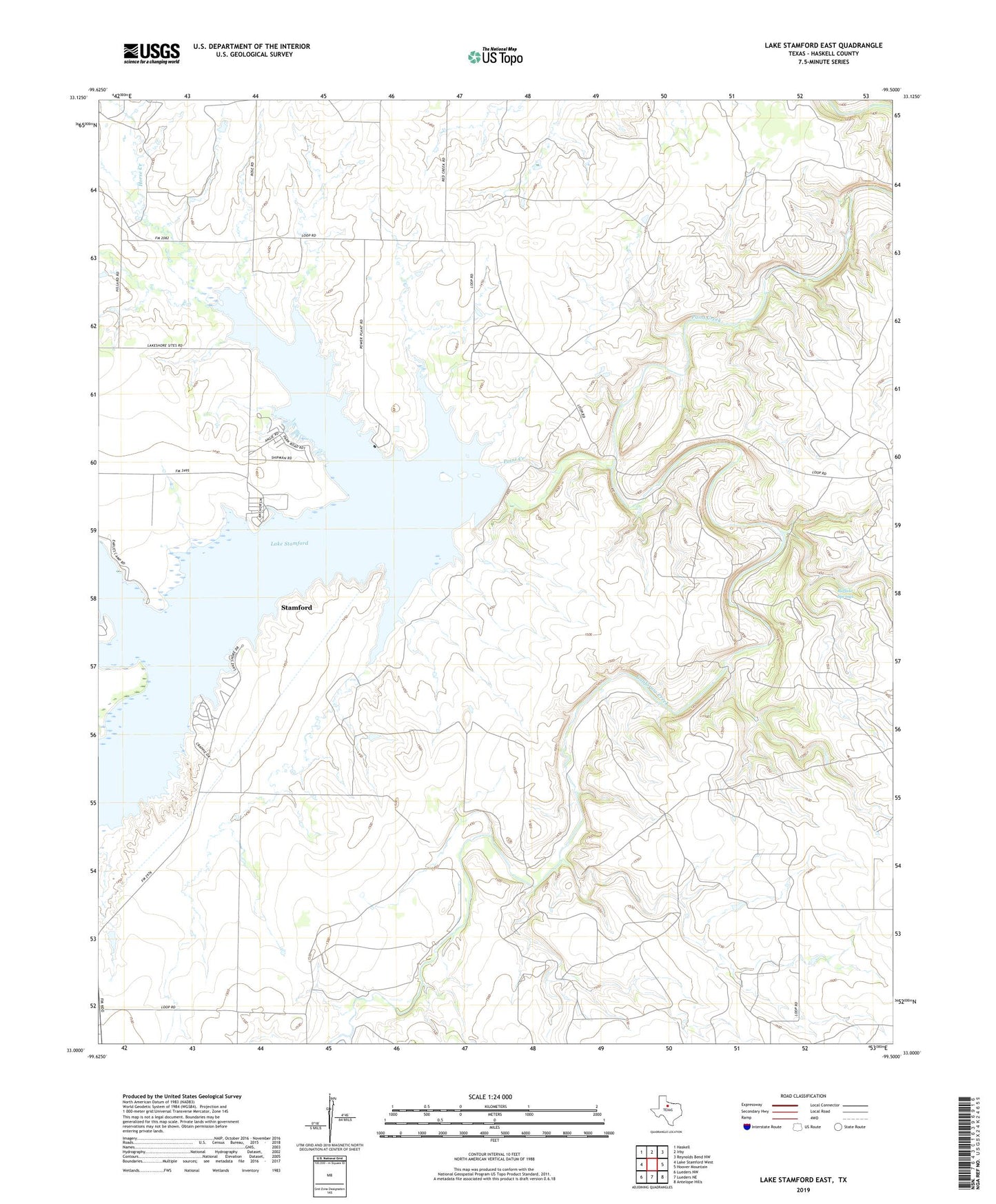
2022 topographic map quadrangle Lake Stamford East in the state of Texas. Scale: 1:24000. Based on the newly updated USGS 7.5' US Topo map series, this map is in the following counties: Haskell. The map contains contour data, water features, and other items you are used to seeing on USGS maps, but also has updated roads and other features. This is the next generation of topographic maps. Printed on high-quality waterproof paper with UV fade-resistant inks.
Quads adjacent to this one:
West: Lake Stamford West
Northwest: Haskell
North: Irby
Northeast: Reynolds Bend NW
East: Hoover Mountain
Southeast: Antelope Hills
South: Lueders NE
Southwest: Lueders NW
This map covers the same area as the classic USGS quad with code o33099a5.
Contains the following named places: Buffalo Springs, California Creek, Haskell Division, Horse Creek, Lake Stamford, Lake Stamford Dam, Lake Stamford Park, Scott Crossing, Scott Memorial Park