MyTopo
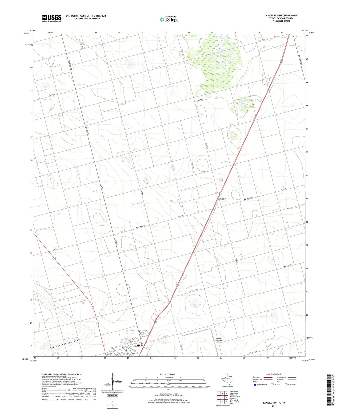
Lamesa North Texas US Topo Map
Couldn't load pickup availability
2022 topographic map quadrangle Lamesa North in the state of Texas. Scale: 1:24000. Based on the newly updated USGS 7.5' US Topo map series, this map is in the following counties: Dawson. The map contains contour data, water features, and other items you are used to seeing on USGS maps, but also has updated roads and other features. This is the next generation of topographic maps. Printed on high-quality waterproof paper with UV fade-resistant inks.
Quads adjacent to this one:
West: Punkin Center
Northwest: Welch East
North: Gooch Lake
East: Hancock
Southeast: Key
South: Lamesa South
Southwest: Patricia NE
This map covers the same area as the classic USGS quad with code o32101g8.
Contains the following named places: Arvana, Calvary United Pentecostal Church, Lamesa Farm Workers Community Historic District, Lamesa Municipal Airport, North Park, Northridge Methodist Church