MyTopo
Lautz Texas US Topo Map
Couldn't load pickup availability
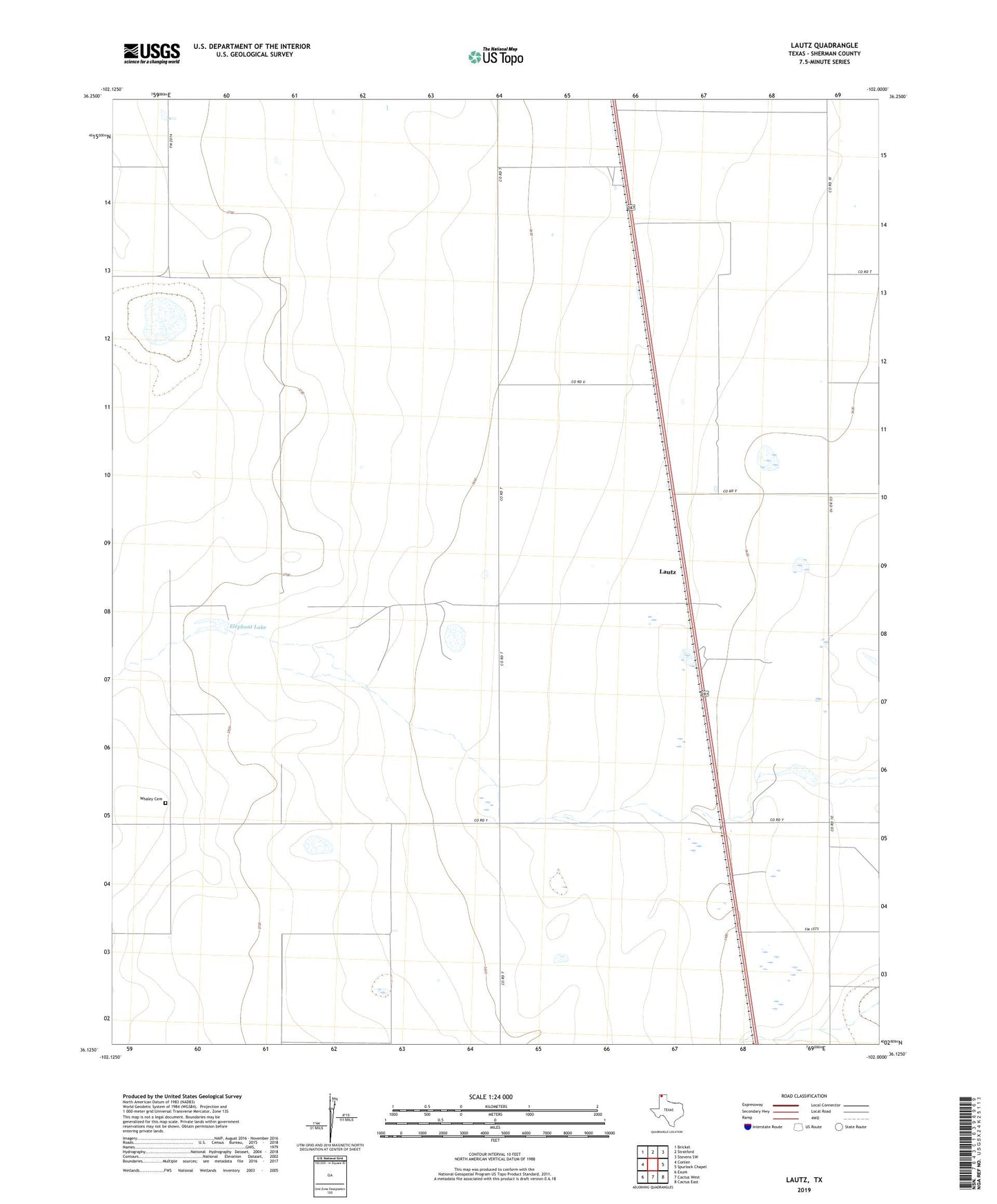
2022 topographic map quadrangle Lautz in the state of Texas. Scale: 1:24000. Based on the newly updated USGS 7.5' US Topo map series, this map is in the following counties: Sherman. The map contains contour data, water features, and other items you are used to seeing on USGS maps, but also has updated roads and other features. This is the next generation of topographic maps. Printed on high-quality waterproof paper with UV fade-resistant inks.
Quads adjacent to this one:
West: Conlen
Northwest: Brickel
North: Stratford
Northeast: Stevens SW
East: Spurlock Chapel
Southeast: Cactus East
South: Cactus West
Southwest: Exum
This map covers the same area as the classic USGS quad with code o36102b1.
Contains the following named places: Elephant Lake, Lautz, Pronger Brothers Ranch Airport, Whaley Cemetery