MyTopo
Leakey Texas US Topo Map
Couldn't load pickup availability
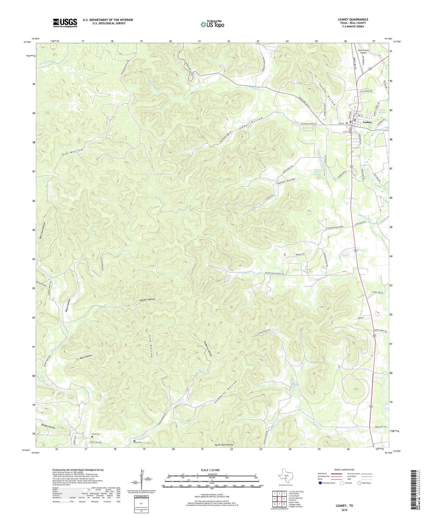
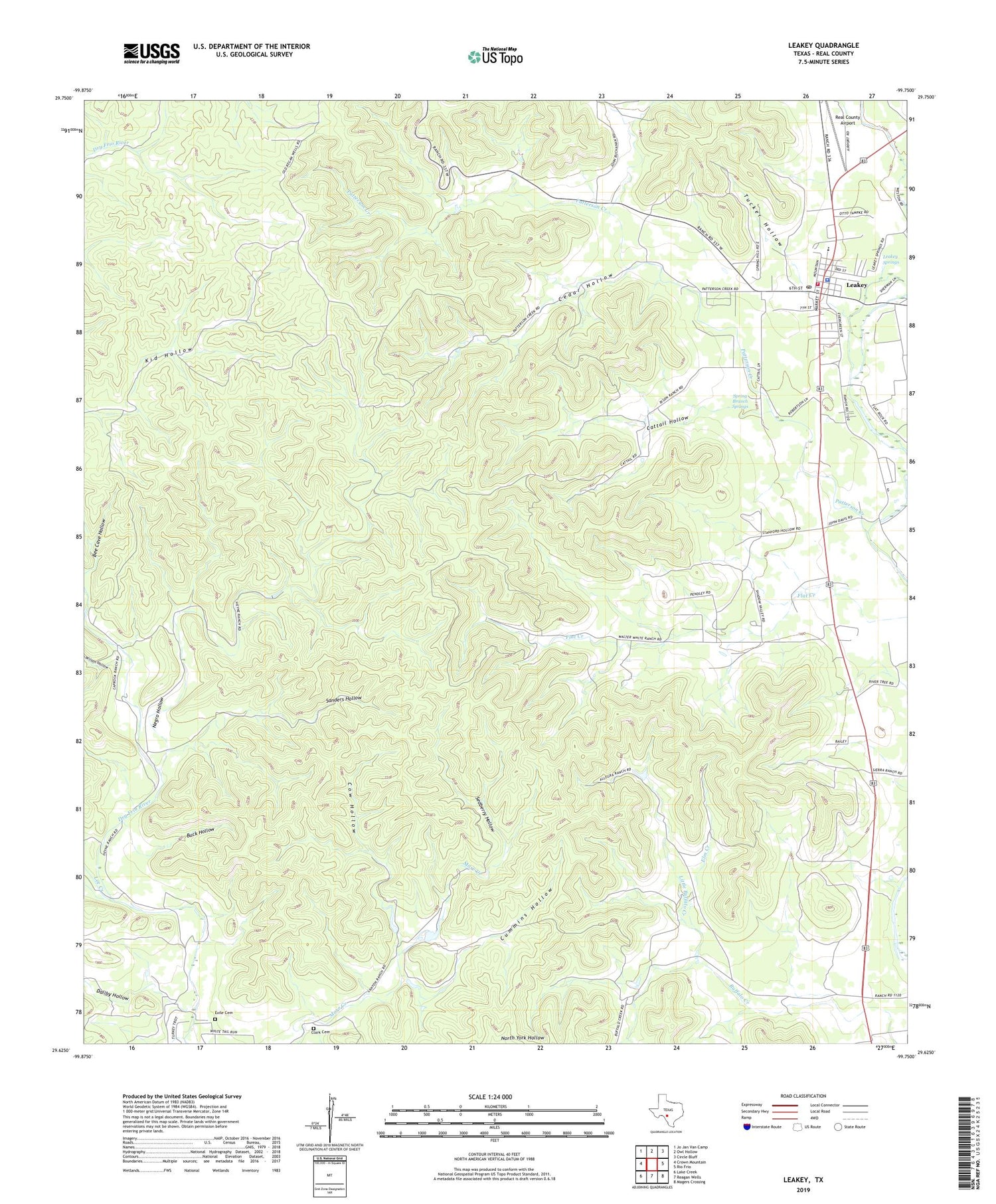
2019 topographic map quadrangle Leakey in the state of Texas. Scale: 1:24000. Based on the newly updated USGS 7.5' US Topo map series, this map is in the following counties: Real. The map contains contour data, water features, and other items you are used to seeing on USGS maps, but also has updated roads and other features. This is the next generation of topographic maps. Printed on high-quality waterproof paper with UV fade-resistant inks.
Quads adjacent to this one:
West: Crown Mountain
Northwest: Jo Jan Van Camp
North: Owl Hollow
Northeast: Circle Bluff
East: Rio Frio
Southeast: Magers Crossing
South: Reagan Wells
Southwest: Lake Creek
Contains the following named places: Alto Frio Encampment, Big Lake, Big Lake Dam, Buck Hollow, Buffalo Creek, Cattail Hollow, Cedar Hollow, City of Leakey, Clark Cemetery, Cow Hollow, Cummins Hollow, Daliby Hollow, Elm Creek, Exile Cemetery, Frio Canyon Emergency Medical Service, Leakey, Leakey City Hall, Leakey Post Office, Leakey Springs, Leakey Volunteer Fire Department, Lee Creek, Leonard Harmon Hollow, Little Buffalo Creek, Patterson Creek, Real County Airport, Real County Jail, Real County Sheriff's Office, Sanders Hollow, Sedberry Hollow, Spring Branch Springs, Tucker Hollow, Wilson Hollow