MyTopo
Reagan Wells Texas US Topo Map
Couldn't load pickup availability
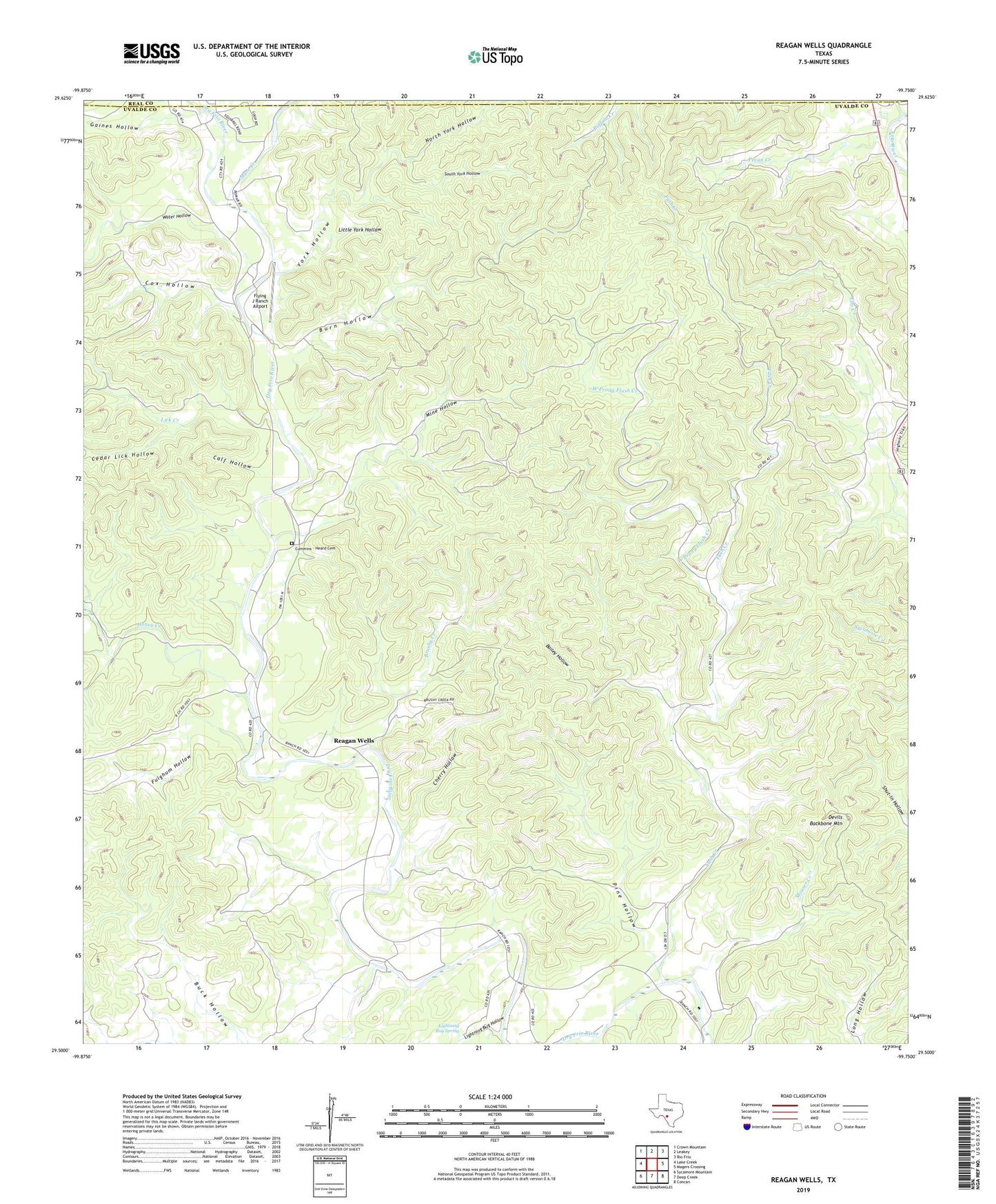
2022 topographic map quadrangle Reagan Wells in the state of Texas. Scale: 1:24000. Based on the newly updated USGS 7.5' US Topo map series, this map is in the following counties: Uvalde, Real. The map contains contour data, water features, and other items you are used to seeing on USGS maps, but also has updated roads and other features. This is the next generation of topographic maps. Printed on high-quality waterproof paper with UV fade-resistant inks.
Quads adjacent to this one:
West: Lake Creek
Northwest: Crown Mountain
North: Leakey
Northeast: Rio Frio
East: Magers Crossing
Southeast: Concan
South: Deep Creek
Southwest: Sycamore Mountain
This map covers the same area as the classic USGS quad with code o29099e7.
Contains the following named places: Bailey Hollow, Brushy Creek, Buck Hollow, Burn Hollow, Calf Hollow, Cedar Lick Hollow, Cherry Hollow, Cox Hollow, Cummins - Heard Cemetery, Devils Backbone Mountain, Flying J Ranch Airport, Fulghum Hollow, Fush Creek, Gaines Hollow, Happy Hollow, Heard Community Center, Honey Creek, Lick Creek, Lightning Bug Hollow, Lightning Bug Spring, Little York Hollow, Long Hollow, Mare Creek, Mine Hollow, Mouser Creek, North York Hollow, Pecan Creek, Pine Hollow, Reagan Wells, South York Hollow, Water Hollow, West Prong Flush Creek, York Hollow