MyTopo
Leander Texas US Topo Map
Couldn't load pickup availability
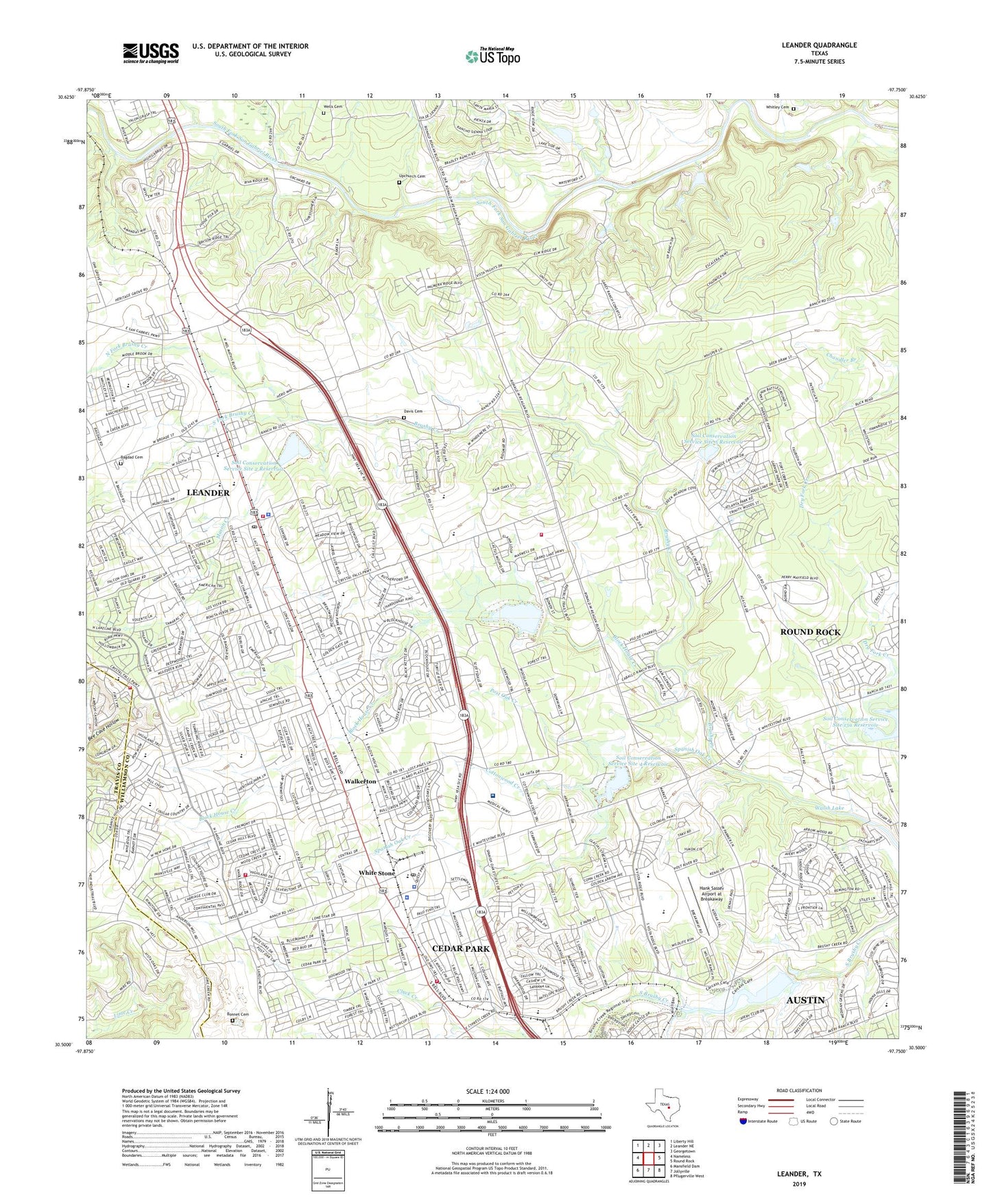
2019 topographic map quadrangle Leander in the state of Texas. Scale: 1:24000. Based on the newly updated USGS 7.5' US Topo map series, this map is in the following counties: Williamson, Travis. The map contains contour data, water features, and other items you are used to seeing on USGS maps, but also has updated roads and other features. This is the next generation of topographic maps. Printed on high-quality waterproof paper with UV fade-resistant inks.
Quads adjacent to this one:
West: Nameless
Northwest: Liberty Hill
North: Leander NE
Northeast: Georgetown
East: Round Rock
Southeast: Pflugerville West
South: Jollyville
Southwest: Mansfield Dam
Contains the following named places: Bagdad Cemetery, Block House Creek, Block House Creek Elementary School, Bonnet Cemetery, Carriage Hills Baptist Church, Cedar Park, Cedar Park Cemetery, Cedar Park Fire Department Station 1, Cedar Park Fire Department Station 3, Cedar Park Police Department, Cedar Park Post Office, Cedar Park Regional Medical Center, Cedar Park United Methodist Church, Cedar Park Volunteer Fire Department, Child Evangelism Fellowship Church, City of Cedar Park, City of Leander, Cottonwood Creek, Dam Number 13A, Dam Number 2, Dam Number 3, Dam Number 4, Dam Number 5, Davis Cemetery, Giddens Elementary School, Hank Sasser Airport at Breakaway, Independent School, Kittie Hill Airport, Lake Will Wilson, Leander, Leander Church of God, Leander City Hall, Leander Fire Department, Leander Fire Department Station 2, Leander High School, Leander Middle School, Leander Police Department, Leander Post Office, Leander Presbyterian Church, Living Hope Community Church, Mason Creek, Mason Elementary School, New Hope Cemetery, New Hope Church, Newsong Baptist Church, North Fork Brushy Creek, Pegasus Place Airstrip, Post Oak Creek, Saint Margaret Mary Catholic Church, Soil Conservation Service Site 13a Dam, Soil Conservation Service Site 13a Reservoir, Soil Conservation Service Site 2 Dam, Soil Conservation Service Site 2 Reservoir, Soil Conservation Service Site 3 Dam, Soil Conservation Service Site 3 Reservoir, Soil Conservation Service Site 4 Dam, Soil Conservation Service Site 4 Reservoir, Soil Conservation Service Site 5 Dam, Soil Conservation Service Site 5 Reservoir, Soil Conservation Service Site 7 Dam, South Fork Brushy Creek, Spanish Oak Creek, Upchurch Cemetery, Walkerton, Walsh Lake, Wells Cemetery, White Stone, White Stone Church, Whitestone Assembly of God Church, Whitestone Elementary School, Whitley Cemetery, Williamson County Academy, Williamson County Constable's Office Precinct 2, Williamson County Emergency Medical Services Cedar Park, Williamson County Emergency Medical Services Leander, Williamson County Sheriff's Office West Substation, ZIP Code: 78613