MyTopo
Liberty Hill Texas US Topo Map
Couldn't load pickup availability
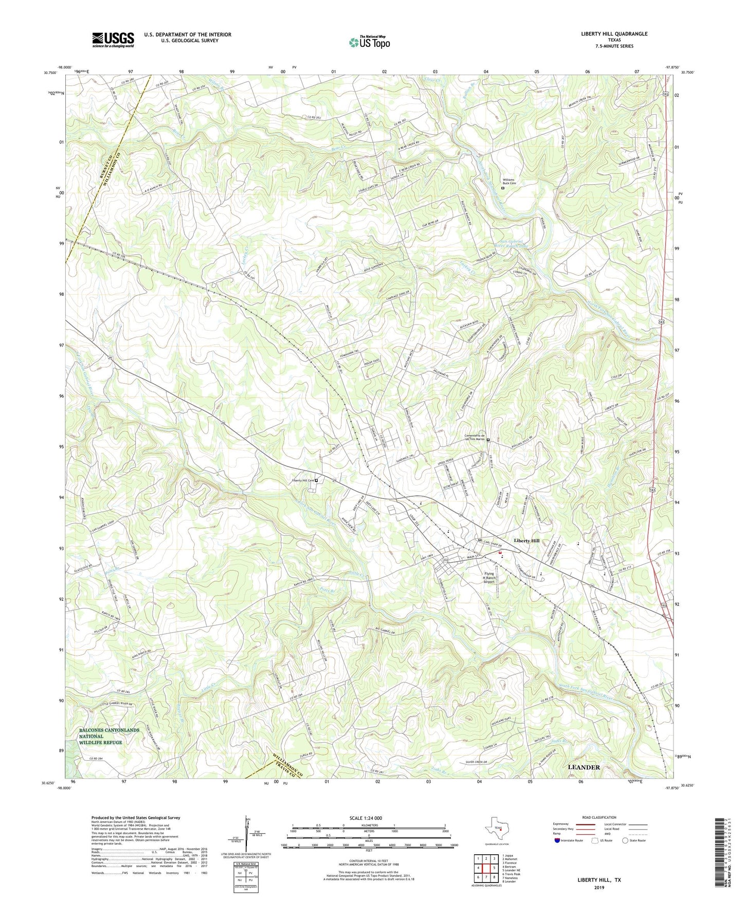
2022 topographic map quadrangle Liberty Hill in the state of Texas. Scale: 1:24000. Based on the newly updated USGS 7.5' US Topo map series, this map is in the following counties: Williamson, Burnet, Travis. The map contains contour data, water features, and other items you are used to seeing on USGS maps, but also has updated roads and other features. This is the next generation of topographic maps. Printed on high-quality waterproof paper with UV fade-resistant inks.
Quads adjacent to this one:
West: Bertram
Northwest: Joppa
North: Mahomet
Northeast: Florence
East: Leander NE
Southeast: Leander
South: Nameless
Southwest: Travis Peak
This map covers the same area as the classic USGS quad with code o30097f8.
Contains the following named places: Bear Creek, Big Branch, Brewer Branch, Bullion Branch, Cementerio de las Tres Marias, Church of Christ, City of Liberty Hill, Clear Creek, Connell Cemetery At Bear Creek, Dog Branch, Flying H Ranch Airport, Jenkins Branch, Jinks Branch, KBTS-FM (Killeen), KLTD-FM (Lampasas), Lackey Creek, Liberty Chapel, Liberty Hill, Liberty Hill Cemetery, Liberty Hill City Hall, Liberty Hill Fire Department, Liberty Hill Post Office, Little Creek, Martha Chapman Dam, Meridell Achievement Center, Potts Branch, San Gabriel River Ranch Lake, San Gabriel River Ranch Lake Dam, Seward Junction, Westwood Special Education, Williams - Buck Cemetery, Wilson Branch, ZIP Code: 78642