MyTopo
Leander NE Texas US Topo Map
Couldn't load pickup availability
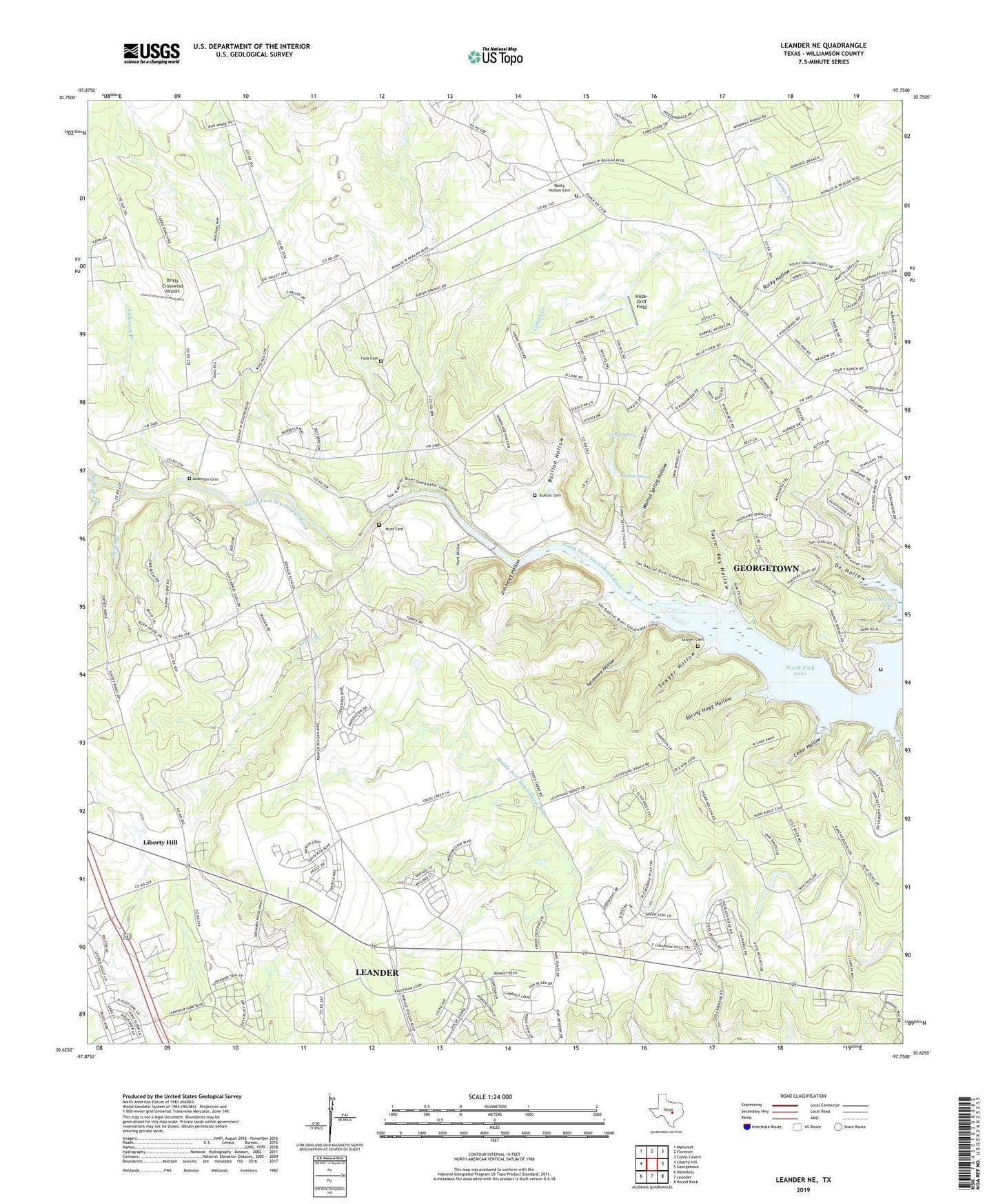
2022 topographic map quadrangle Leander NE in the state of Texas. Scale: 1:24000. Based on the newly updated USGS 7.5' US Topo map series, this map is in the following counties: Williamson. The map contains contour data, water features, and other items you are used to seeing on USGS maps, but also has updated roads and other features. This is the next generation of topographic maps. Printed on high-quality waterproof paper with UV fade-resistant inks.
Quads adjacent to this one:
West: Liberty Hill
Northwest: Mahomet
North: Florence
Northeast: Cobbs Cavern
East: Georgetown
Southeast: Round Rock
South: Leander
Southwest: Nameless
This map covers the same area as the classic USGS quad with code o30097f7.
Contains the following named places: 4BH Heliport, 78628, Anderson Branch, Anderson Cemetery, Britts Crosswind Airport, Bullion Cemetery, Bullion Hollow, Camp Spring, Camp Spring Hollow, Cedar Hollow, Crockett Gardens, Dyeus Branch, Fore Cemetery, Hamilton Branch, Hilde-Griff Field, Hunt Cemetery, Hunt Crossing, Hunt Hollow, Jenkins Cemetery, Jennings Branch, Jim Hogg Hollow, Knight Spring, Ox Hollow, Rock House, Rocky Hollow, Rocky Hollow Cemetery, Russell Crossing, Russell Park, Santa Rita Ranch, Santa Rita Ranch Census Designated Place, Sawyer Cemetery, Sawyer Hollow, Sawyer Park, Sowes Branch, Spring Hogg Hollow, Sycamore Hollow, Taylor Ray Hollow, Union Chapel, Union Hall Church, Walnut Spring, Walnut Spring Hollow, Walnut Spring Park