MyTopo
Leonard Texas US Topo Map
Couldn't load pickup availability
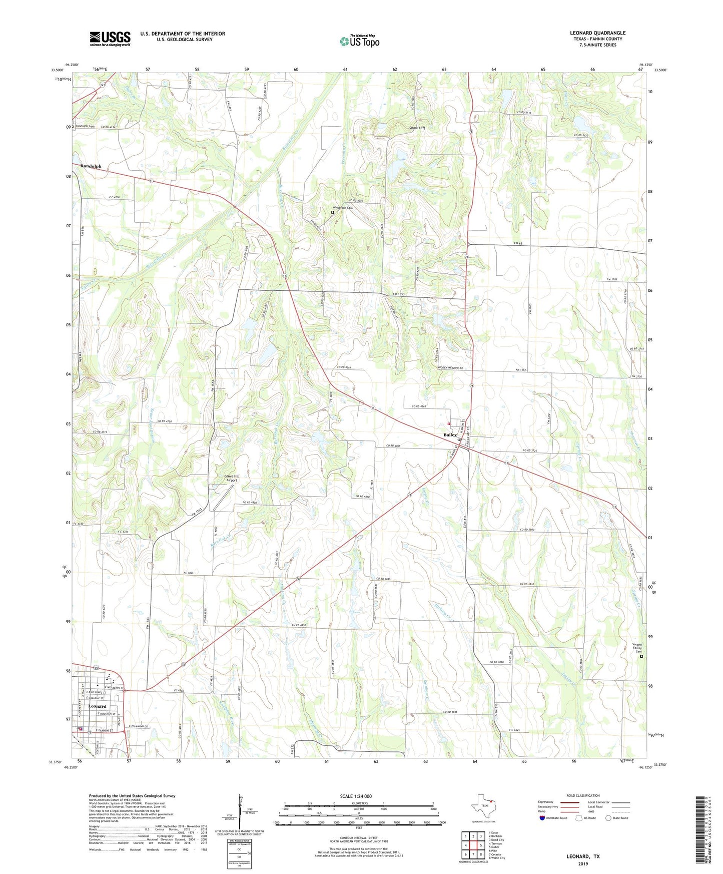
2019 topographic map quadrangle Leonard in the state of Texas. Scale: 1:24000. Based on the newly updated USGS 7.5' US Topo map series, this map is in the following counties: Fannin. The map contains contour data, water features, and other items you are used to seeing on USGS maps, but also has updated roads and other features. This is the next generation of topographic maps. Printed on high-quality waterproof paper with UV fade-resistant inks.
Quads adjacent to this one:
West: Trenton
Northwest: Ector
North: Bonham
Northeast: Dodd City
East: Gober
Southeast: Wolfe City
South: Celeste
Southwest: Pike
Contains the following named places: Bailey, Bailey City Hall, Bailey Post Office, Bailey Volunteer Fire Department, Burr Oak Creek, City of Bailey, City of Leonard, Correa Lake, Correa Lake Dam, Doyle Family Cemetery, Dyers Branch, Fannin County Constable's Office Precinct 2, First Baptist Church of Leonard, First Christian Academy of Leonard, Gilbert Lake, Gilbert Lake Dam, Grove Hill Airport, Grove Hill Cemetery, Grove Hill Church, Leonard, Leonard City Hall, Leonard Division, Leonard High School, Leonard Junior High School, Leonard Police Department, Leonard Post Office, Leonard Volunteer Fire Department, Portland Church, Purdue Lake, Purdue Lake Dam, Randolph Cemetery, Snow Hill, Sugar Loaf Bottom, Taylor Dam, Taylor Lake, Texas No Name Number 32 Dam, Texas No Name Number 33 Dam, Valley Creek, Valley Creek Community Center, Vaughn Family Cemetery, White Rock Cemetery, ZIP Codes: 75413, 75452, 75475