MyTopo
Lingleville Texas US Topo Map
Couldn't load pickup availability
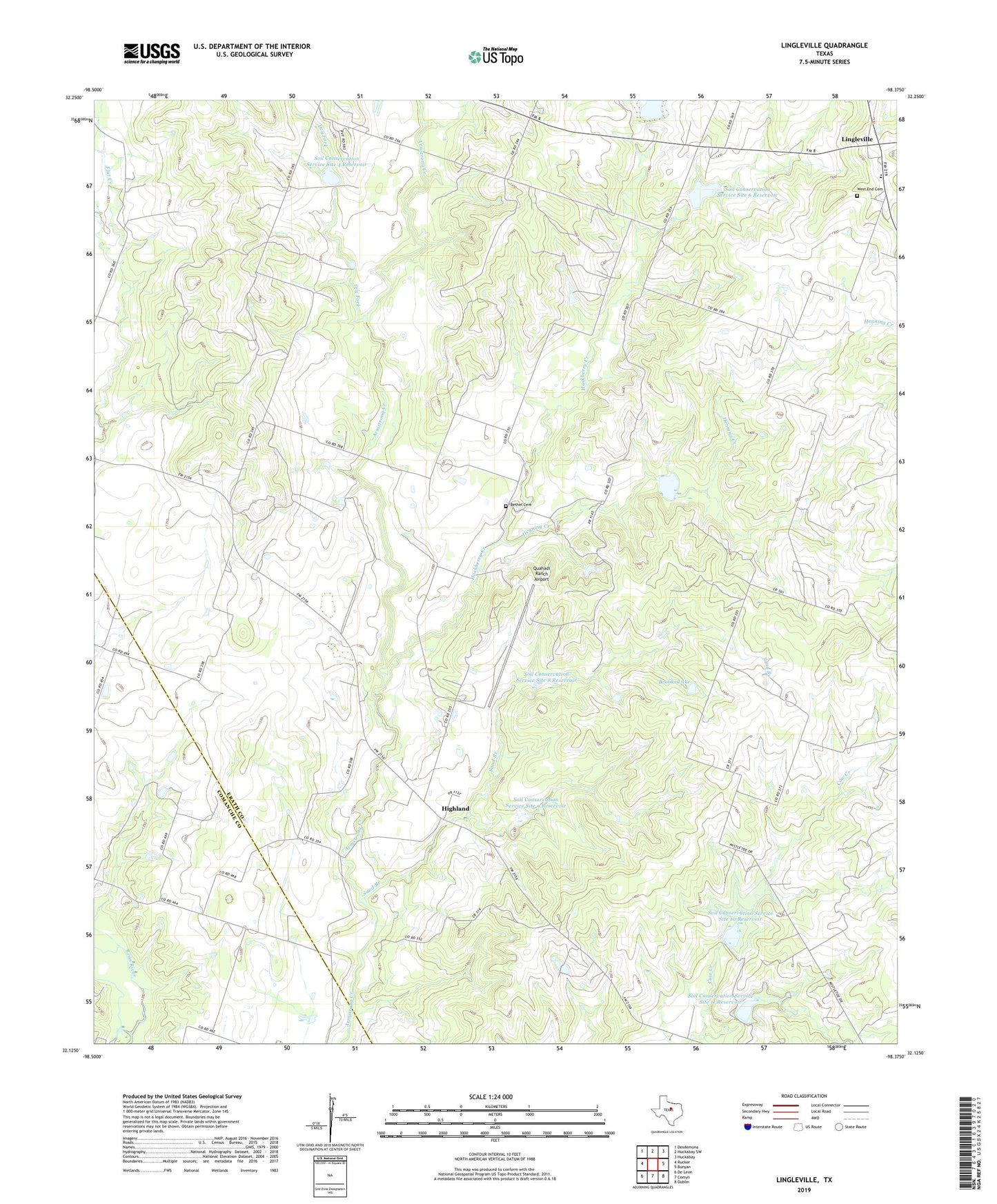
2019 topographic map quadrangle Lingleville in the state of Texas. Scale: 1:24000. Based on the newly updated USGS 7.5' US Topo map series, this map is in the following counties: Erath, Comanche. The map contains contour data, water features, and other items you are used to seeing on USGS maps, but also has updated roads and other features. This is the next generation of topographic maps. Printed on high-quality waterproof paper with UV fade-resistant inks.
Quads adjacent to this one:
West: Rucker
Northwest: Desdemona
North: Huckabay SW
Northeast: Huckabay
East: Bunyan
Southeast: Dublin
South: Comyn
Southwest: De Leon
Contains the following named places: Bethel Cemetery, Brooks Lake, Brooks Lake Dam, Dam Number 10, Dam Number 11, Dam Number 5, Dry Fork, Hackberry Creek, Henning Creek, Highland, Highland Church, Lingleville, Lingleville Census Designated Place, Quahadi Ranch Airport, Round Grove Church, Sand Branch, Soil Conservation Service Site 10 Dam, Soil Conservation Service Site 10 Reservoir, Soil Conservation Service Site 11 Dam, Soil Conservation Service Site 11 Reservoir, Soil Conservation Service Site 4 Dam, Soil Conservation Service Site 4 Reservoir, Soil Conservation Service Site 5 Dam, Soil Conservation Service Site 5 Reservoir, Soil Conservation Service Site 6 Dam, Soil Conservation Service Site 6 Reservoir, Soil Conservation Service Site 7 Dam, Soil Conservation Service Site 7 Reservoir, Soil Conservation Service Site 8 Dam, Soil Conservation Service Site 8 Reservoir, Soil Conservation Service Site 9 Dam, Soil Conservation Service Site 9 Reservoir, Victor, West End Cemetery