MyTopo
De Leon Texas US Topo Map
Couldn't load pickup availability
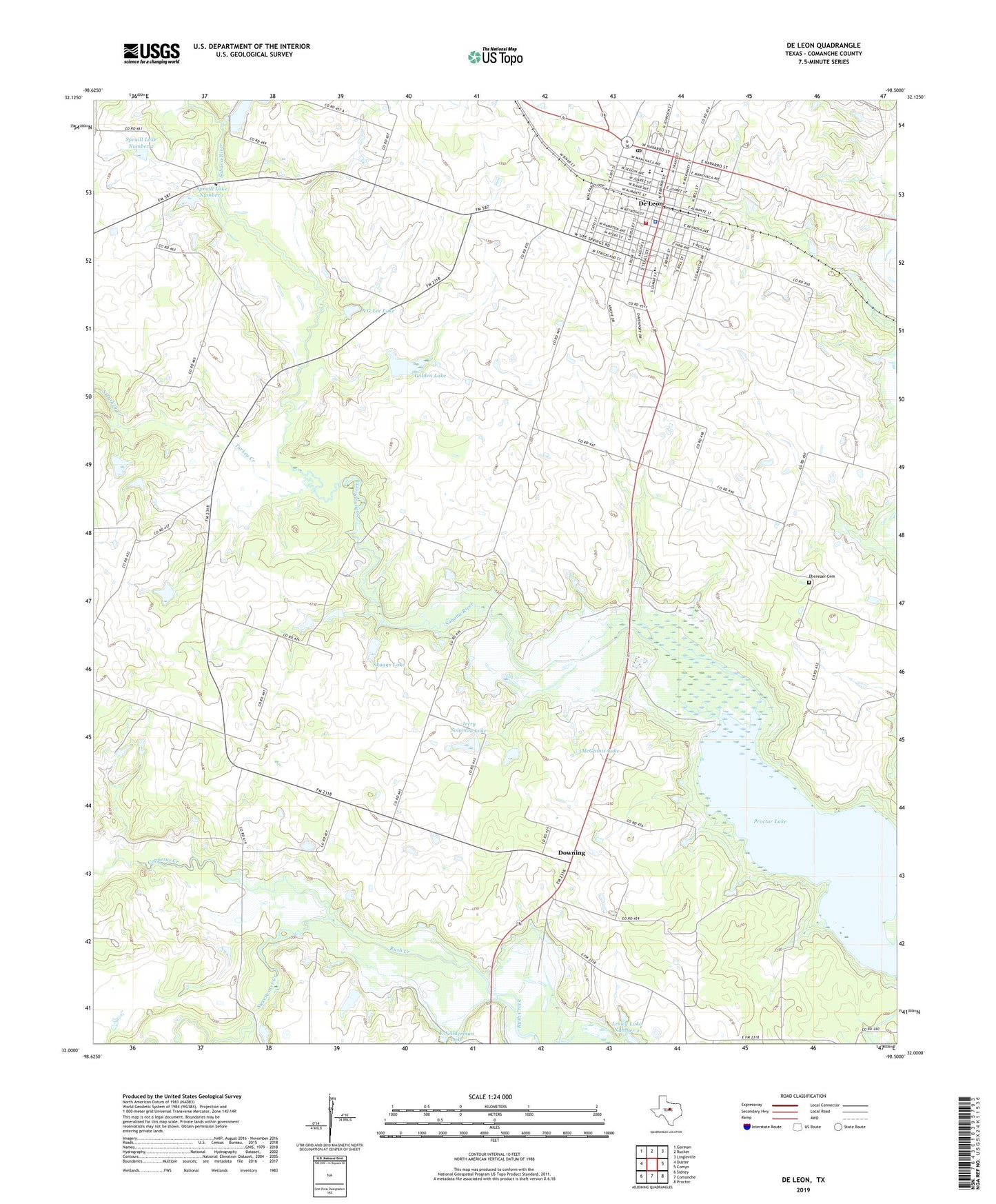
2022 topographic map quadrangle De Leon in the state of Texas. Scale: 1:24000. Based on the newly updated USGS 7.5' US Topo map series, this map is in the following counties: Comanche. The map contains contour data, water features, and other items you are used to seeing on USGS maps, but also has updated roads and other features. This is the next generation of topographic maps. Printed on high-quality waterproof paper with UV fade-resistant inks.
Quads adjacent to this one:
West: Duster
Northwest: Gorman
North: Rucker
Northeast: Lingleville
East: Comyn
Southeast: Proctor
South: Comanche
Southwest: Sidney
This map covers the same area as the classic USGS quad with code o32098a5.
Contains the following named places: A G Lee Dam, A G Lee Lake, Bible Baptist Church, Church of Christ, City of De Leon, Copperas Creek, De Leon, De Leon Cemetery, De Leon City Hall, De Leon Division, De Leon Elementary School, De Leon High School, De Leon Hospital, De Leon Municipal Airport, De Leon Police Department, De Leon Post Office, De Leon Volunteer Fire Department, Downing, E J Alderman Dam, Ebenezer Cemetery, First Baptist Church, Golden Dam, Golden Lake, Jerry Solomon Dam, Jerry Solomon Lake, Lesley Lake Number 2, Lesley Lake Number 2 Dam, McGinnis Dam, McGinnis Lake, Morton Chapel, Nabors Lake, Nabors Lake Dam, North Turkey Creek, Northside Baptist Church, Old De Leon Cemetery, Perkins Middle School, Pounds, Sabana River, Skaggs Dam, Skaggs Lake, South Turkey Creek, Spruill Dam Number 1, Spruill Dam Number 2, Spruill Lake Number 1, Spruill Lake Number 2, Sweetwater Creek, Turkey Creek, United Pentecostal Church, ZIP Code: 76444