MyTopo
Comyn Texas US Topo Map
Couldn't load pickup availability
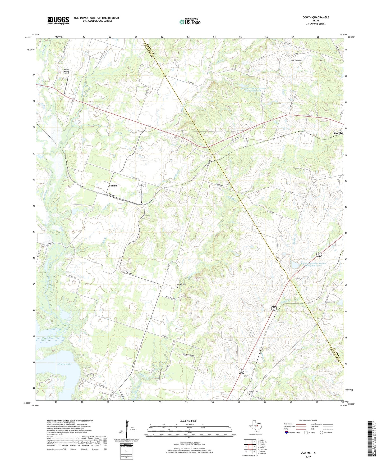
2022 topographic map quadrangle Comyn in the state of Texas. Scale: 1:24000. Based on the newly updated USGS 7.5' US Topo map series, this map is in the following counties: Comanche, Erath. The map contains contour data, water features, and other items you are used to seeing on USGS maps, but also has updated roads and other features. This is the next generation of topographic maps. Printed on high-quality waterproof paper with UV fade-resistant inks.
Quads adjacent to this one:
West: De Leon
Northwest: Rucker
North: Lingleville
Northeast: Bunyan
East: Dublin
Southeast: Edna Hill
South: Proctor
Southwest: Comanche
This map covers the same area as the classic USGS quad with code o32098a4.
Contains the following named places: Armstrong Creek, Comyn, Cow Creek, Cow Creek Cemetery, Hanson Cemetery, High Point Park, Mill Branch, Pleasant Home Church, Proctor Cemetery, Roch, Smith Flying Service, Soil Conservation Service Site 12 Dam, Soil Conservation Service Site 12 Reservoir, Soil Conservation Service Site 25 Dam, Soil Conservation Service Site 25 Reservoir, Soil Conservation Service Site 26 Dam, Soil Conservation Service Site 26 Reservoir, Walker Creek