MyTopo
Lipscomb Texas US Topo Map
Couldn't load pickup availability
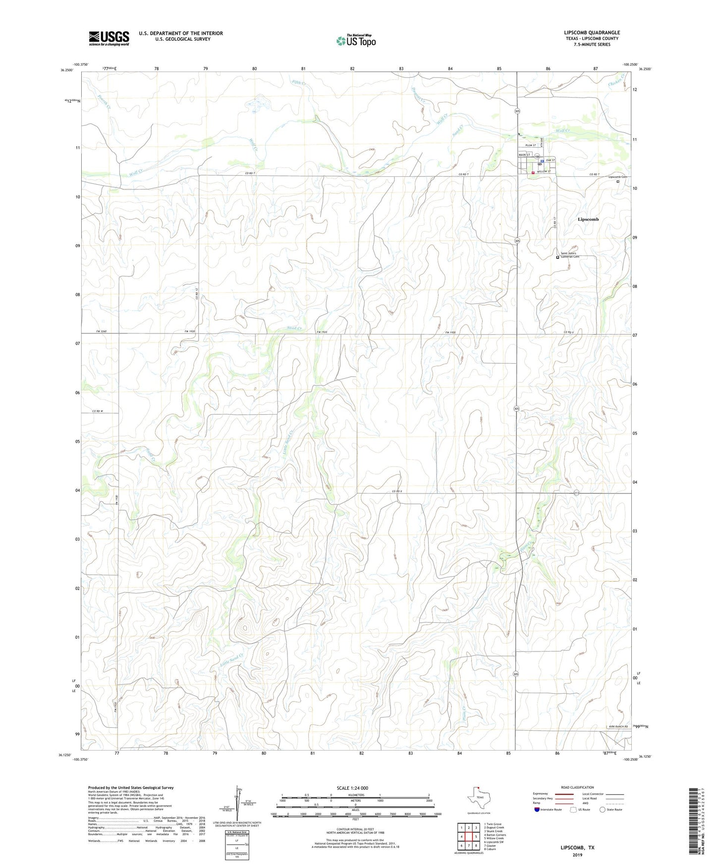
2022 topographic map quadrangle Lipscomb in the state of Texas. Scale: 1:24000. Based on the newly updated USGS 7.5' US Topo map series, this map is in the following counties: Lipscomb. The map contains contour data, water features, and other items you are used to seeing on USGS maps, but also has updated roads and other features. This is the next generation of topographic maps. Printed on high-quality waterproof paper with UV fade-resistant inks.
Quads adjacent to this one:
West: Barton Corners
Northwest: Twin Grove
North: Dugout Creek
Northeast: Skunk Creek
East: Willow Creek
Southeast: Coburn
South: Glazier
Southwest: Lipscomb SW
This map covers the same area as the classic USGS quad with code o36100b3.
Contains the following named places: Chicken Creek, Dugout Creek, Fifth Creek, Fourth Creek, Gene Howe Wildlife Management Area - Murphy Unit, Higgins - Lipscomb Volunteer Fire Department Station 2, Higgins Division, Lipscomb, Lipscomb Cemetery, Lipscomb Census Designated Place, Lipscomb County Sheriff's Office, Lipscomb Post Office, Little Sand Creek, Saint John's Lutheran Cemetery, Sand Creek, Wolf Creek Heritage Museum